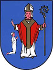
Stanisławów (Powiat Miński)
| Stanisławów | ||
|---|---|---|

|
|
|
| Basic data | ||
| State : | Poland | |
| Voivodeship : | Mazovia | |
| Powiat : | Mińsk Mazowiecki | |
| Geographic location : | 52 ° 17 ' N , 21 ° 33' E | |
| Residents : | see Gmina | |
| Postal code : | 05-304 | |
| Telephone code : | (+48) 25 | |
| License plate : | WM | |
| Gmina | ||
| Gminatype: | Rural community | |
| Gmina structure: | 29 school authorities | |
| Surface: | 106.01 km² | |
| Residents: | 6777 (Jun. 30, 2019) |
|
| Population density : | 64 inhabitants / km² | |
| Community number ( GUS ): | 1412142 | |
| Address: | ul.Rynek 32 05-304 Stanisławów |
|
Stanisławów is a village and seat of the rural community of the same name in the Powiat Miński of the Masovian Voivodeship , Poland .
local community
The rural community ( gmina wiejska ) Stanisławów includes the following 29 localities with a Schulzenamt ( sołectwo ) :
- Borek Czarniński
- Choiny
- Ciopan
- Cisówka
- Czarna
- Goździówka
- Stanisławów Colony
- Legacz
- Lubomin
- Ładzyń
- Łęka
- Mały Stanisławów
- Ołdakowizna
- Papiernia
- Porąb
- Prądzewo-Kopaczewo
- Pustules
- Retków
- Rządza
- Sokóle
- Stanisławów
- Szymankowszczyzna
- Sukhovitsna
- Wólka Czarnińska
- Wólka-Konstancja
- Wólka Piecząca
- Wólka Wybraniecka
- Zalesie
- Zawiesiuchy
Another place in the municipality is Poręby Leśne.
Individual evidence
- ↑ population. Size and Structure by Territorial Division. As of June 30, 2019. Główny Urząd Statystyczny (GUS) (PDF files; 0.99 MiB), accessed December 24, 2019 .
