
Ambrock quarry
| Ambrock quarry | |||
|---|---|---|---|
| General information about the mine | |||
 |
|||
| Mining technology | Open pit | ||
| Information about the mining company | |||
| Funded raw materials | |||
| Degradation of | Greywacke | ||
| Geographical location | |||
| Coordinates | 51 ° 19 '31.8 " N , 7 ° 30' 9.9" E | ||
|
|||
| Location | Ambrock | ||
| City ( NUTS3 ) | Hagen | ||
| country | State of North Rhine-Westphalia | ||
| Country | Germany | ||

The Ambrock quarry is located west of Ambrock , a district of Hagen , which is located on the Volme . In it is greywacke broken down. The Brandenberg strata from the Middle Devonian period about 387 million years ago are open . The Hamper Bach runs south of the quarry and the Kuhweider Bach runs north .
Opposite the entrance area of the large quarry, on the other side of the Hamper Bach, there is an abandoned small quarry in the same rock that is classified as a geotope .
geology
Geologically, the quarry is located on the northern flank of the Remscheid-Altenaer saddle . The Brandenberg strata dip in this area at around 30 - 40 ° to the north. The layers are characterized by an alternating sequence of gray, green and red rocks, red clay and silt stones allow them to be distinguished from the older and younger units in the hanging and lying areas . In addition, sandstones are essential components of the sequence of layers, which also justify the degradability.
The up to 700 m thick Brandenberg layers were created by deposits in a land-sea transition area of the so-called Old-Red continent . The red sediment horizons , on the other hand, are likely to be traced back to land as deposits, since they do not show any marine fossils and dry cracks and carbonate nodules indicate the origin of the desert climate.
In individual rock layers, mussels and brachiopods can be found, which indicate brackish water or marine deposits close to the coast - as well as the primeval tank fish , barbed sharks and other fossils that can sometimes be found . In other rock layers, plant enrichment with roots indicates shallow freshwater areas or land vegetation.
The variety of rock layers exposed in the quarry suggest that the layers were deposited in a flat sea coast with a river delta.

Dismantling

processing
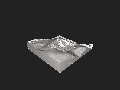
3D terrain model of the quarry


literature
- PIECHA, M. & RIBBERT, K.-H. & WREDE, V. (2008): The Paleozoic in the southern Ruhr area. - In: Kirnbauer, Th., Rosendahl, W. & Wrede, V .: Geological excursions in the National GeoPark Ruhrgebiet: 149-185; Eat.
See also
Web links
Individual evidence
- ↑ Quarry Ambrock on the website of Kies und Split GmbH - archive version (accessed on May 2, 2020)
- ↑ https://geopark.metropoleruhr.de/geopark-ruhrgebiet/geopark-enthaben/geotope/hagen-ambrock.html