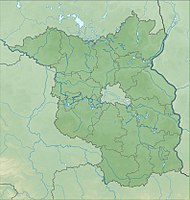
Arch of folds south of Döbern
|
Arch of folds south of Döbern
|
||
| location | Brandenburg , Germany | |
| surface | 93.3 ha | |
| Identifier | 1351 | |
| WDPA ID | 163025 | |
| Geographical location | 51 ° 36 ' N , 14 ° 36' E | |
|
|
||
| Setup date | 2nd October 1992 | |
The arc of folds nature reserve south of Döbern is located in the area of the city of Döbern in the Spree-Neisse district in Brandenburg .
The area with the identification number 1351 was placed under nature protection by ordinance of October 2, 1992 . The 93.3 hectare nature reserve extends south of the core town of Döbern. Not far from the eastern edge runs the B 115 and on the north-western edge the state road L 49. To the west of the area extends the approximately 95.5 hectare nature reserve Reuthener Moor , to the south runs the state border with Saxony .


