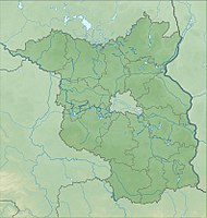
Koselmühlenfließ (nature reserve)
|
Koselmühlenfließ
|
||
| location | Brandenburg , Germany | |
| surface | 112 ha | |
| Identifier | 1323 | |
| WDPA ID | 378113 | |
| Geographical location | 51 ° 40 ′ N , 14 ° 11 ′ E | |
|
|
||
| Setup date | May 31, 2006 | |
The Koselmühlenfließ nature reserve is located in the area of the city of Drebkau and the municipality of Kolkwitz in the Spree-Neisse district in Brandenburg .
The area with the identification number 1323 was placed under nature protection by ordinance of May 5, 2006 . The approximately 112 hectare nature reserve extends southwest of the core town of Kolkwitz and west and northwest of the core town of Drebkau along the Koselmühlen river . At the northern edge of the area runs the state road L 49 and through the area the A 15 and the L 52. To the east run the L 521 and the B 169 . The approximately 288 hectare nature reserve Glinziger pond and meadow area extends to the north and the 457 hectare Gräbendorfer See lake to the west .
meaning
The nature reserve comprises the "valley of a nutrient-poor lowland brook of the Niederlausitzer Landrücken with a largely natural course."
See also
Web links
Individual evidence
- ↑ Ordinance on the “Koselmühlenfließ” nature reserve of May 5, 2006 on bravors.brandenburg.de, accessed on May 1, 2020


