Gräbendorfer See
| Gräbendorfer See | ||
|---|---|---|

|
||
| Gräbendorfer See | ||
| Geographical location | Brandenburg | |
| Data | ||
| Coordinates | 51 ° 42 '6 " N , 14 ° 6' 35" E | |
|
|
||
| surface | 4.57 km² | |
| Maximum depth | 55 m | |
|
particularities |
Recultivated open pit lake |
|
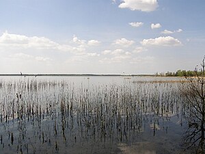
The Gräbendorfer See , in Lower Sorbian Grabicański jazor , is a 457 hectare recultivated open pit lake in the Lusatian Lakeland . The flooding ended in 2007. It is located in the Oberspreewald-Lausitz district in Brandenburg near the Spreewald and is fully usable. The action artist Ben Wagin realized one of his projects here on his bank.
location
The lake is located north of Altdöbern and southwest of Wüstenhain in the Oberspreewald-Lausitz district in Brandenburg , making it the northernmost lake in the Lusatian Lakeland , which mainly consists of flooded open-cast lignite mines. Neighboring communities are Drebkau , Vetschau / Spreewald and Altdöbern.
Formation of the lake
As part of the recultivation of the post-mining landscape , the flooding of the remaining hole in the former Gräbendorf open-cast mine began on March 20, 1996. In May 2007, the flooding was completed with the help of around 100 million cubic meters of water from the Spree . It is the first completely planned flooded open-cast lignite mining lake in Brandenburg and the Lusatian Lake District in the more recent development of the Lusatian lignite mining area . The local recreation area Bad Erna and the Grünewalder Lauch in Brandenburg as well as the Knappenrode storage facility in Saxony are older.
Time series
- 1979: Start of the mining development of the Gräbendorf opencast mine
- 1980: Beginning of field drainage
- 1981: Exploration dredging begins
- September 28, 1984: Start of coal production
- 1992: Ending the overburden movement and coal mining
- 1994: start of recultivation
- March 20, 1996: start of flooding
- May 8, 2007: End of the flooding, connection to the receiving water "Greifenhainer Fließ"
Data
| Gräbendorfer See (since 1996) | |
|---|---|
| Water surface | 457 hectares |
| Memory content | 93 million cubic meters |
| Water level | 67.5 m above sea level |
| Real estate | Neighboring communities Drebkau, Vetschau / Spreewald, Altdöbern (since 2003) |
| Opencast mining output (1981–1992) | |
|---|---|
| Overburden | 126.8 million cubic meters |
| advancement | 36.0 million tons of raw lignite |
| Total mining land use | 834.6 ha |
Places that completely or partially fell victim to opencast mining:
| place | year | Affected residents |
|---|---|---|
| Reddern (in part) | 1979 | 2 |
| Laasow (partly) | 1987 | 17th |
| Laasdorf (complete) | 1989 | 15th |
| Gräbendorf (complete) | 1989 | 40 |
Bird sanctuary
The island on the eastern bank is the core of an area of approx. 170 hectares as part of the European bird sanctuary "Lausitz Mining Post Landscape" owned by the Brandenburg Nature Conservation Fund.
use
The Gräbendorfer See has been fully flooded since May 2007. It will remain calmer compared to the other lakes in the lake district. It is one of the few lakes in the Lusatian Lakeland with good bathing water quality ; the others have relatively acidic water . On the north-west bank between Laasow and Wüstenhain (municipality of Vetschau / Spreewald) there will be a bathing beach, while the east bank will retain its natural character.
The LMBV began in 1994 with the recultivation of the remaining hole of the disused brown coal opencast mine "Gräbendorf". There are two viewpoints from which you can watch the transformation to the lake. A paved circular path around the lake is 9.4 km long and can be covered by bike, inline skates or on foot.
Floating living

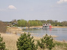
Immediately to the east of the village of Laasow, the International Building Exhibition (IBA) Fürst-Pückler-Land is currently realizing the project " Floating Houses Gräbendorfer See". The outdoor facilities of a planned floating settlement were completed in 2005/2006. The first house to be built in 2006 was a floating diving school on a pontoon. On August 16, 2006 the diving school was opened in the presence of the Brandenburg Prime Minister Matthias Platzeck .
Near the south bank are works of art by the action artist Ben Wagin ; the village of Gräbendorf was originally located at this point, which was completely demolished in 1989.


