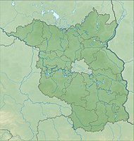
Glinziger pond and meadow area
|
Glinziger pond and meadow area
|
||
| location | Brandenburg , Germany | |
| surface | 2.88 km² | |
| Identifier | 1455 | |
| WDPA ID | 555552557 | |
| Geographical location | 51 ° 45 ' N , 14 ° 13' E | |
|
|
||
| Setup date | November 27, 2012 | |
The nature reserve Glinziger Teich- und Wiesengebiet lies in the area of the municipality Kolkwitz in the district Spree-Neisse in Brandenburg .
The area with the identification number 1455 was placed under nature protection by ordinance of November 27, 2012 . The approximately 288 hectare nature reserve extends north and east of Glinzig and south of Dahlitz - both districts of Kolkwitz. The state road L 49 runs through the area with the upper and lower pond. To the west of it runs the L 512 and to the south-west the A 15 .
meaning
The nature reserve is "characterized by the large number of ponds, small bodies of water and ditches with rich and largely intact natural features."
See also
Web links
Individual evidence
- ↑ Ordinance on the “Glinziger Teich- und Wiesengebiet” nature reserve from November 20, 2012 on bravors.brandenburg.de, accessed on March 14, 2020


