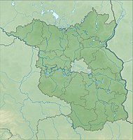
Zschorno Forest
|
Zschorno Forest
|
||
| location | Brandenburg , Germany | |
| surface | 6.28 km² | |
| Identifier | 1466 | |
| WDPA ID | 319370 | |
| Geographical location | 51 ° 36 ' N , 14 ° 40' E | |
|
|
||
| Setup date | May 13, 2002 | |
The Zschornoer Wald nature reserve is located in the area of the municipalities of Jämlitz-Klein Düben , Neiße-Malxetal and Tschernitz in the Spree-Neiße district in Brandenburg .
The area with the identification number 1466 was placed under nature protection by ordinance of May 13, 2002 . The approximately 628 hectare nature reserve extends north of Zschorno , a part of the municipality of Jämlitz-Klein Düben. The B 115 runs west of the area and the B 156 south-west . The Lusatian Neisse flows to the east and the Föhrenfließ not far to the south. The state border with Saxony runs on the northeastern edge and the state border with Poland to the east .
Between 1972 and 1990 the bombing and shooting range 31 Jerischke of the Preschen airfield was located in this area , which means that today there is a high level of ammunition and duds in this area.
See also
Web links
- World Database on Protected Areas - Zschornoer Wald (English)
- Ordinance on the “Zschornoer Wald” nature reserve of May 13, 2002 on bravors.brandenburg.de, accessed on October 22, 2019
Individual evidence
- ↑ Matthias Matern: Natural heritage given away. In: Potsdam's latest news . June 18, 2012, accessed October 23, 2019 .
- ↑ Bomb throwing and ground shooting range 31. Accessed on October 23, 2019 .


