Still Bay
| Still Bay Stilbaai, Stilbay |
||
|---|---|---|
|
Mouth of the Goukou River into Still Bay |
||
| Waters | Indian Ocean | |
| Land mass | southern africa | |
| Geographical location | 34 ° 24 ′ 31 ″ S , 21 ° 30 ′ 36 ″ E | |
|
|
||
| Tributaries | Goukou River | |
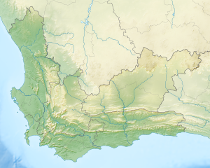
The Still Bay ( Afrikaans Stilbaai ) is a bay on the South African coast of the Indian Ocean . Your water areas adjacent to the territory of hessequa local municipality - local church at. The largest and only flowing water with an estuary in the bay is the Goukou River (formerly: Kafferkuils River ).
The bay represents a section in the Duineveld landscape, which stretches from Walker Bay to Mossel Bay. The dune slopes between 10 and 30 meters high do not form shifting dunes , as they are largely covered with vegetation. Grassy areas and coastal macchia ("Rhenosterbusch") occur alternately. The coastline stretching to the east from the village of Stilbaai is almost uninhabited and characterized by some small, also private nature reserves. In the hinterland, the coastal plain, which is predominantly characterized by dunes, merges into the foreland of the Langeberg mountain range .
There are only two urban settlements on the bay's coast. This includes the place of the same name Stilbaai . The settlement is embedded in the natural dune landscape, the vegetation of which forms a dense vegetation. The mouth of the Goukou River is used as a bathing beach.
A road bridge over the estuary of the Goukou River in the district of Stilbaaihoogte connects the town center on its west bank with the district of Lappiesbaai on the east bank. There is a small landing strip for airplanes on both sides. The bay and the town can be reached by road on the 26 km long regional road R305, which branches off the national road N2 to the south-east at Riversdale .
A regional connecting road leads from Stilbaai West to the resort of Jongensfontein to the west and ending there and on the edge of the bay .
The bay was placed under protection as a Marine Protected Area (MPA) in 2008. Together with the onshore Geelkrans Nature Reserve , the coastal zone has a comprehensive protection status (under CapeNature). The fishing is allowed in some areas. However, it is prohibited in Geelkrans , Skulpiesbaai and the Goukou estuary. The mouth of the Goukou River was the first estuary in the province to be included in a marine reserve of South Africa.
Archaeologists found prehistoric fishing facilities in some sections of the bay in the form of basins demarcated with stones, which acted as a trap for fish when the tide was low . They were used by indigenous groups who lived as hunters and gatherers and who have been displaced here since the 18th century by the immigration of European settlers. According to estimates, the possible age of these structures can be 2000 to 3000 years on the basis of sea level data.
The name of the bay refers to the calm water conditions in this section of the coastline.
Web links
- Still Bay Tourism / Stilbaai Toerisme: website . on www.stilbaaitourism.co.za (English)
Individual evidence
- ↑ Traugott Molter: Water balance and irrigation agriculture in the Cape . Franz Steiner Verlag , Wiesbaden 1966, pp. 18-19
- ↑ a b according to OSM
- ^ Molter: water balance . 1966, pp. 17, 19
- ^ Western Cape Nature Conservation Board: Marine Protected Areas. Stilbaai MPA . on www.capenature.co.za (English)
- ^ John Gribble: Pre-Colonial Fish Traps On the South Western Cape Coast, South Africa . In: R. Grenier, D. Nutley, I. Cochran (Eds.): Underwater Cultural Heritage at Risk: Managing Natural and Human Impacts . P. 29–31, ICOMOS , Paris, online at www.icomos.org (English, PDF).
- ^ Peter Edmund Raper : Dictionary of Southern African Place Names . Lowry Publishers, Johannesburg 1987 (2nd ed.), P. 304

