Stockweiherbach (Würzbach)
| Stockweiherbach | ||
|
Headwaters of the Stockweiherbach |
||
| Data | ||
| Water code | DE : 264282 | |
| location |
Saarland
|
|
| River system | Rhine | |
| Drain over | Würzbach → Blies → Saar → Moselle → Rhine → North Sea | |
| source | at the St. Ingbert district of Hassel 49 ° 15 ′ 49 ″ N , 7 ° 8 ′ 52 ″ E |
|
| Source height | 255 m | |
| muzzle | at Rittershof I on the L111 in Würzbach Coordinates: 49 ° 15 '2 " N , 7 ° 10' 43" E 49 ° 15 '2 " N , 7 ° 10' 43" E |
|
| Mouth height | 242 m | |
| Height difference | 13 m | |
| Bottom slope | 4.3 ‰ | |
| length | over 3 km | |
| Catchment area | 5.67 km² | |
| Reservoirs flowed through | Griesweiher | |
| Residents in the catchment area | 3500 | |
The Stockweiherbach is a left tributary of the Würzbach, coming from the northwest, in the Hassel district of the city of St. Ingbert in the Saarpfalz district in Saarland .
geography
course
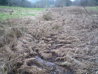
The source area of the brook lies in a flat meadow area. The small tributary Stocklandbach flows into it from the left . In its further course the Stockweiherbach flows through the Griesweiher before it flows into the Würzbach coming from the Ritterstal near the Rittershof I.
Griesweiher
The Griesweiher is a smaller pond on the district of Hassel in the Saarpfalz district.
traffic
The railway line to the Hasseler Tunnel once ran parallel to the Stockweiherbach .
Individual evidence
- ↑ a b Dimension of the apparently strongly generalized polygon that can be displayed on Geoportal Saarland map viewer for Saarland ( information )
