Strassen (Luxembourg)
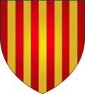
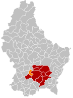
| coat of arms | map |
|---|---|

|

|
| Basic data | |
| State : |
|
| Coordinates : | 49 ° 37 ' N , 6 ° 4' E |
| Canton : | Luxembourg |
| Residents : | 9589 (January 1, 2019) |
| Area : | 10.7 km² |
| Population density : | 895.3 inhabitants / km² |
| Municipality number: | 0309 |
| Website: | www.strassen.lu |
| politics | |
| Mayor: | Gaston Greiveldinger ( LSAP ) (October 11, 2011) |
| Elective system : | Proportional vote |
Strassen ( Luxembourgish Stroossen ) is a municipality in the Grand Duchy of Luxembourg and belongs to the canton of Luxembourg .
origin of the name
The name Strassen comes from the Latin word "strata", which means something like military road. In Roman times this road ran from Trier to Arel through the villages of Strassen and Mamer .
Population development

Individual evidence
Web links
Commons : Strassen - collection of images, videos and audio files
- Website of the municipality of Strassen
- Syvicol: Strassen (PDF; 2.2 MB)