Sulztalferner
| Sulztalferner | ||
|---|---|---|
|
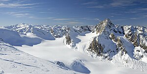
Sulztalferner from the east, from Hinteren Daunkopf , in November 2010 |
||
| location | Tyrol , Austria | |
| Mountains | Stubai Alps | |
| Type | Valley glacier | |
| length | 3.7 km (2011) | |
| surface | 3.59 km² (2006) | |
| Exposure | North | |
| Altitude range | 3350 m - 2290 m (1975) | |
| Ice thickness | ⌀ 48 m (1987) | |
| Ice volume | 0.22 km³ (1987) | |
| Coordinates | 47 ° 0 '0 " N , 11 ° 4' 48" E | |
|
|
||
| drainage | Wannenbach → Fischbach → Ötztaler Ache → Inn | |
The Sulztalferner is one of the largest glaciers in the Stubai Alps . It is located at the end of the Sulztal north of the Windacher Daunkogel ( 3351 m ) and east of the Wilden Leck ( 3361 m ). Between 1997 and 2006 the Sulztalferner lost 0.32 km² in area, this was the greatest absolute loss of area of the Austrian glaciers in the Stubai Alps.
The nutrient area of the glacier is framed in the northwest by the Wütenkar peaks (up to 3244 m ), which are separated from the northwest ridge of the Windacher Daunkogel by the Wütenkar saddle. The ridge running from its western pre-summit, the western Daunkogel ( 3300 m ), to the north to Daunscharte and Daunjoch forms the eastern border of the glacier's nutrient zone. In the further course of this ridge, the Hintere Daunkopf ( 3225 m ) rises . Starting from the southern ridge of the Wilde Leck, the small Wilde-Leck-Ferner flows into the Sulztalferner from the west.
The Sulztalferner is one of the three Tyrolean glaciers where the green algae Mesotaenium berggrenii has been identified as cryoconite . In contrast to the red snow caused by snow algae, areas colonized by such green algae can hardly be seen with the naked eye, because these algae cause a blackish-dark brown coloration only in the best case, which can have a dark purple tinge in sunlight.
map
- Alpine club map sheet 31/2, 1: 25,000, Stubai Alps, Hochstubai . ISBN 3-928777-08-4
Web links
Individual evidence
- ↑ a b c WGMS: Fluctuations of Glaciers Database. World Glacier Monitoring Service, Zurich 2012 ( DOI: 10.5904 / wgms-fog-2012-11 ), accessed on February 7, 2013
- ↑ M. Mergili: Compilation of the changes in length of the Austrian glaciers 1970–2013. ( online ( Memento of the original from January 27, 2016 in the Internet Archive ) Info: The archive link has been inserted automatically and has not yet been checked. Please check the original and archive link according to the instructions and then remove this note. ). Based on: Austrian Alpine Association: Glacier Reports. Collective reports on the glacier measurements of the Austrian Alpine Club from 1971 to 2011. Compiled by H. Kinzl, G. Patzelt, A. Fischer. In: Messages from the Austrian Alpine Club / Uphill. Volume 27-67. Retrieved April 30, 2013
- ↑ a b Bernd Seiser: 2006 Glacier Inventory of the Stubai Alps. Diploma thesis, University of Innsbruck, 2010 ( online ; PDF; 58.8 MB)
- ↑ a b University of Vienna, Central Institute for Meteorology and Geodynamics: Seismic ice thickness Austrian glacier. In: Archive for deposit research of the Federal Geological Institute. Vienna 1987, Volume 8, p. 27f ( online ; PDF file; 320 kB)
- ↑ Birgit Sattler, Daniel Remias, Cornelius Lütz, Hieronymus Dastych, Roland Psenner: Life on snow and ice. In: Brigitta Verschbamer, Eva M Koch (ed.): Glacial and periglacial habitats in the Obergurgl area. Innsbruck University Press, Innsbruck 2010, pp. 229–249 ISBN 3-902719-50-8 ( online )

