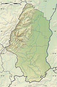
Tete des Faux
| Tete des Faux | ||
|---|---|---|
| height | 1208 m | |
| location | Haut-Rhin , Grand Est , France | |
| Mountains | Vosges | |
| Coordinates | 48 ° 9 '15 " N , 7 ° 7' 1" E | |
|
|
||
| Development | Hiking trails, mountain bikes, groomed trails in winter | |
| particularities | Battlefield in World War I | |
The Tête des Faux (Eng. Beech head) is a mountain peak in the Vosges .
history
Due to the exposed position and a good view from the summit, the mountain was strategically important in the First World War and accordingly contested. The front line ran right across the summit; the remains of military installations such as gun emplacements and bunkers are still visible today. On the "Roche de Corbeau" (Eng. Raven Rock) a little to the east is the former mountain station of a cable car, with which material was transported from Lapoutroie to the summit. To the west of the summit is the French military cemetery "Cimetière Duchesne". The German military cemetery further to the east was abandoned and the bones transferred to Collet du Linge .
The remains of the military installations in the summit area and at the Roche de Courbeau as well as the mountain station of the cable car have been under monument protection as Monument historique since 1932 .
description
The GR 5 long-distance hiking trail leads over the summit . The massif is accessible through signposted hiking trails, mountain bike routes and, in winter, through groomed trails. The ascent from Le Bonhomme takes about two hours, with a little over 500 meters of altitude to be overcome.
literature
- Bernhard Pollmann: Vosges, 51 tours, Rother hiking guide. Bergverlag Rother , Emden 2016, pp. 102f., ISBN 978-3-7633-4018-7 .
Individual evidence
- ↑ Champ de bataille de la Tête des Faux in the Base Mérimée of the French Ministry of Culture (French)
