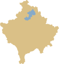
Tërstena (Mitrovica)
|
Tërstena / Tërstenë 1 Trstena / Трстена 2 |
||||
|
||||
| Basic data | ||||
|---|---|---|---|---|
| State : |
|
|||
| District : | Mitrovica | |||
| Municipality : | Mitrovica e Jugut | |||
| Coordinates : | 42 ° 55 ' N , 20 ° 58' E | |||
| Height : | 993 m above sea level A. | |||
| Residents : | 163 (2011) | |||
| Telephone code : | +383 (0) 28 | |||
| License plate : | 02 | |||
|
1 Albanian (indefinite / definite form) , 2 Serbian (Latin / Cyrillic spelling) 3 Kosovo's independence is controversial. Serbia continues to regard the country as a Serbian province. |
||||
Tërstena ( Albanian also Tërstenë , Serbian Трстена Trstena ) is a village in northern Kosovo and belongs to the municipality of Mitrovica e Jugut .
geography
Tërstena is 18 kilometers east of Mitrovica and 14 kilometers north of Vushtrria . The village can be reached from Vushtrria via the M-2 and from Mitrovica via the R-129 . There is a bus stop to the north and south of the village. Tërstena has a cemetery.
population
ethnicities
In the 2011 census, 163 residents were recorded for Lisica. 162 of these identified themselves as Albanians (99.39%), one referred to themselves as Bosniaks .
| census | 1948 | 1953 | 1961 | 1971 | 1981 | 1991 | 2011 |
|---|---|---|---|---|---|---|---|
| Residents | 377 | 433 | 465 | 470 | 545 | 632 | 163 |
religion
In 2011, all of the 163 residents professed Islam .
Individual evidence
- ↑ Ethnic composition of Kosovo 2011. In: pop-stat.mashke.org. Retrieved March 19, 2018 .
- ↑ Kosovo censuses. In: pop-stat.mashke.org. Retrieved March 19, 2018 .
- ↑ Tim Bespyatov: Religious composition of Kosovo 2011 . Retrieved March 19, 2018.


