Tössegg
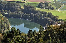
The Tössegg is the place where the Töss meets the Rhine . It belongs to the municipality of Freienstein-Teufen and is located in the north of the canton of Zurich at an altitude of 346 m above sea level. M. Here, the Rhine flowing from the northeast turns towards the northwest.
The four municipalities of Buchberg , Eglisau , Rorbas and Freienstein-Teufen as well as the cantons of Schaffhausen and Zurich border each other near Tössegg .
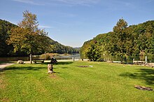
The Tössegg lies between the Irchel , Dattenberg and Rhinsberg hills . As a place close to nature with bathing opportunities, barbecue areas, restaurant and boat connection to the Rhine Falls , it serves as a destination for excursions. To the southeast above the Tössegg are the ruins of a Roman watchtower.
The WWF beaver path leads from Tössegg to Rüdlingen . This hike can be combined with a boat trip on the Rhine.
A ferry connects the Tössegg with the opposite bank of the Rhine.
Web links
- WWF beaver path at myswitzerland.com
- Development concept Tössegg on awel.zh.ch
- Tössegg jury report on awel.zh.ch


