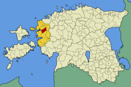
Taebla (rural community)
| Taebla | |||
|
|||
| State : |
|
||
| Circle : |
|
||
| Coordinates : | 58 ° 57 ' N , 23 ° 45' E | ||
| Area : | 141 km² | ||
| Residents : | 2,911 (Jan. 1, 2008) | ||
| Population density : | 21 inhabitants per km² | ||
| Time zone : | EET (UTC + 2) | ||
| Telephone code : | (+372) 047 | ||
| Postal code : | 90801 | ||
| Community type: | former rural community | ||
| Postal address : | Pargi tn 6 90801 Taebla |
||

|
|||
Taebla (German: Taibel ) is a former rural community in the Estonian district of Lääne with an area of 141 km². It had 2739 inhabitants (as of January 1, 2006).
Taebla was 14 km from Haapsalu and 86 km from Tallinn .
The untouched landscapes with forests, moors and springs were interesting for nature tourists. The former house of the national romantic painter Ants Laikmaa (1866–1942), which served as a museum about his life and work, was particularly worth seeing in Kadarpiku .
Villages
In addition to the main town Taebla ( Taebla alevik ), the rural community also included the villages Allikmaa , Kadarpiku , Kirimäe , Koela , Kedre , Luigu , Nigula , Nihka , Leediküla , Palivere , Pälli , Tagavere , Turvalepa , Väänla , Vidruka and Võntküka . In 2013, Oru and Risti merged to form the rural community of Lääne-Nigula .
Web links
- Ants Laikmaa Museum in Kadarpiku (Estonian)
- Koela Peasant and Local History Museum (Estonian)

