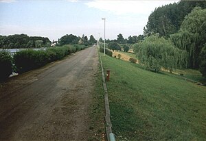
Windischleuba dam
| Windischleuba dam | |||||||
|---|---|---|---|---|---|---|---|
|
Windischleuba dam, view over the dam crest |
|||||||
|
|||||||
|
|
|||||||
| Coordinates | 51 ° 2 '28 " N , 12 ° 28' 0" E | ||||||
| Data on the structure | |||||||
| Construction time: | 1951-1953 | ||||||
| Height above valley floor: | 6.13 m | ||||||
| Height of the structure crown: | 163 m | ||||||
| Crown length: | 400 m | ||||||
| Slope slope on the air side : | 1: 3.5 | ||||||
| Slope slope on the water side : | 1: 3 | ||||||
| Data on the reservoir | |||||||
| Altitude (at congestion destination ) | 161.2 m | ||||||
| Water surface | 1.3 km² | ||||||
| Storage space | 2.03 million m³ | ||||||
| Total storage space : | 2.28 million m³ | ||||||
| Catchment area | 595 km² | ||||||
The Windischleuba dam dams the Pleiße between Fockendorf and Windischleuba in Thuringia in the Altenburger Land district and is approx. 40 km from Leipzig. Exceptionally, it is operated by the Saxon state dam administration and not by the Thuringian long-distance water supply.
The dam used to be controlled with a combined bottom outlet and flood relief structure in the Pleiße and a separate extraction structure on the Mühlgraben. The relief structure on the Pleiße has been out of service since the beginning of the 21st century. The low water level was held by a temporary ring dam that was poured in front of the dam.
The building was renovated from 2007 to 2009. The bottom outlet and the flood relief were replaced by a 54.5 meter wide overflow threshold . As a result, the dam is no longer controllable and can only hold back floods to a limited extent. The project also included the establishment of a fish pass in the form of a bypass channel and the renewal of the bridge leading over the dam.
The barrier structure is now an earth dam with an inclined inner seal and a water-side sealing skirt. The reservoir of the dam is heavily silted up because the Pleiße is very sediment-rich and there is no bed load trap. A natural softwood floodplain has developed on the river delta-like alluvial fan . Today, with the remaining water surface, this is mainly used for bird and nature protection and is not allowed to be entered.
See also
Web links
Individual evidence
- ↑ Make new out of old . In: Lafarge Forum . No. 3 , 2008, p. 14 ( PDF on Archive.org [accessed July 28, 2017]).
- ^ State dam administration Saxony: Staumeisterei Regis. Windischleuba dam. Retrieved July 28, 2017 .


