Taraco Peninsula
| Taraco Peninsula | ||
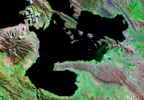
 Satellite image of the peninsula |
||
| Geographical location | ||
|
|
||
| Coordinates | 16 ° 27 ′ 0 ″ S , 68 ° 52 ′ 0 ″ W | |
| Waters 1 | Lake Titicaca | |
| length | 17 km | |
| width | 6 km | |
| surface | ||
The Taraco Peninsula extends on the Bolivian side into the smaller, southern part of Lake Titicaca , the Wiñaymarka . It runs from east to west into the lake. The peninsula belongs to the districts (Municipios) Taraco and Santa Rosa de Taraco in the province of Ingavi ( Department La Paz ). The town of Taraco and the largest town on the peninsula, the scattered settlement Ñachoca, are also located on it . Other places on the peninsula are Sapana , Opoqueri , Santa Rosa de Taraco , Iguague and Chivo .
Web links
- Municipio Taraco - detailed map and population data (PDF; 317 kB) (Spanish)
