Tehri dam
| Tehri dam | |||||||||
|---|---|---|---|---|---|---|---|---|---|
| Tehri dam | |||||||||
|
|||||||||
|
|
|||||||||
| Coordinates | 30 ° 22 '40 " N , 78 ° 28' 50" E | ||||||||
| Data on the structure | |||||||||
| Lock type: | Rockfall dam | ||||||||
| Construction time: | 1978-2002 | ||||||||
| Height above foundation level : | 261 m | ||||||||
| Crown length: | 610 m | ||||||||
| Power plant output: | 1 000 MW | ||||||||
| Data on the reservoir | |||||||||
| Water surface | 52 km² | ||||||||
| Storage space | 3540 million m³ | ||||||||
| Design flood : | 11,800 m³ / s | ||||||||
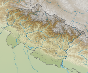
The Tehri Dam is the largest dam of the "Tehri Hydro Project", a large hydroelectric power plant project near Tehri in the state of Uttarakhand in India .
At 261 m, the Steinschüttdamm is currently the fifth to tenth highest dam in the world, depending on how it is counted. The rivers Bhagirathi and Bhilangna are dammed .
The hydropower plants will have a total capacity of 2400 megawatts . This consists of the Tehri hydropower plant (1,000 MW) and the Tehri pumped storage power plant (1,000 MW) at the main dam and the Koteshwar Hydro Hydro Power Plant 14 (or 22) km downstream at Koteshwar , where another power plant with an output of 400 MW is to be created. In the first phase, however, only 1,000 MW will be available. This is said to be the most powerful power plant complex in India.
In addition, the dam stabilizes the irrigation of 6,000 km² and extends the irrigation area by a further 2,700 km². It also supplies industrialized cities in Delhi , Uttar Pradesh and Uttarakhand with 1 million m³ of drinking water per day. Originally, construction costs of four million US dollars were expected. In the meantime the equivalent of 1 billion dollars has already been spent and in some cases the total costs are given as 2 billion dollars.
Planning began in 1972 and construction work in 1978 . The "Tehri Hydro Development Corporation" (THDC) was founded on July 12, 1988 as a joint project of the Government of India and the Government of Uttar Pradesh (before Uttarakhand split off from Uttar Pradesh) to oversee the construction of the dam. The main part of the project is to build the dam near the ancient city of Tehri, which is located at the confluence of the Bhagirathi rivers, the largest tributary of the Ganges , and the Bhilangana. The water area of the reservoir will cover 52 km² . The ancient city of Tehri and 112 villages will sink into the water and 100,000 people will be relocated.
There were intense protests against this dam by environmental groups and the population in the region. Resistance to the resettlement of more than 100,000 people led to protracted legal battles and long delayed the project. In addition to environmental concerns about the location of large dams in the sensitive ecosystem at the foot of the Himalayas, there are also concerns about the safety of the dam. The Tehri Dam is located on the Central Himalayan Fold, a major geological fault zone . In October 1991 there was an earthquake in this region with a magnitude of 6.8 on the Richter scale , with the epicenter 50 km from the dam location. Several hundred people died in the earthquake. Scientists fear that a magnitude 8 earthquake could damage the dam as well. - There was a serious accident in one of the tunnels in August 2004 when part of the tunnel collapsed during heavy rainfall.
After a court ruling, tunnel T2 of the dam was closed on October 29, 2005 , thus initiating the filling of the reservoir. This was actually planned for December 2002. Two other deeper tunnels, T3 and T4, were closed in December 2001. But the closing of the T2 tunnel has led to yet another controversy because it has reduced the flow of the Bhagirathi to 2 m³ / s instead of the normal 1000 m³ / s. According to Hindu mythology, the river Bhagirathi is the actual Ganges (which bears the same name as the goddess Ganga ), although the river is named Ganga or "Ganaga" only from the confluence of the Bhagirathi with the Alaknanda at Devprayag . If the amount of Bhagirathi water is so reduced, hardly any Bhagirathi water will reach the Ganges 80 km away. The sanctity of the Ganga is thereby diminished and this has generated resentment.
But the filling of the dam continued. The generator test run could begin at 720 m. The first generator has been on the grid since June 2006 and supplies electricity.
See also
- List of hydropower plants in India
- List of dams in the world (India)
- List of the largest dams on earth
- List of the largest reservoirs on earth
Web links
- Tehri dam , a factsheet published by the International Rivers Network (October 2002)
- Official website of the Tehri Hydro Development Corporation Limited, the organization in charge of the dam's construction
- Tehri: The Sinking Town a traveler's account of Tehri dam
- India: Tehri Dam
- Tehri Dam (pdf)
- Tehri dam: Power generation from March
- Newspaper articles
- India goes ahead with Tehri dam (December 8, 2001)
- Indian court clears dam project (September 2, 2003)
- India tunnel collapse toll rises (August 4, 2004)
- A Dam Shame , article from Grist Magazine (June 8, 2004)

