Ternoise
| Ternoise | ||
|
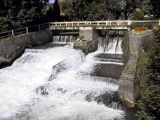
The Ternoise at Auchy-lès-Hesdin |
||
| Data | ||
| Water code | FR : E5400650 | |
| location | France , Hauts-de-France region | |
| River system | Canche | |
| Drain over | Canche → English Channel | |
| source | in the municipality of Ligny-Saint-Flochel 50 ° 21 ′ 58 ″ N , 2 ° 24 ′ 54 ″ E |
|
| Source height | approx. 110 m | |
| muzzle | at Huby-Saint-Leu in the Canche coordinates: 50 ° 22 ′ 54 ″ N , 2 ° 0 ′ 41 ″ E 50 ° 22 ′ 54 ″ N , 2 ° 0 ′ 41 ″ E |
|
| Mouth height | approx. 22 m | |
| Height difference | approx. 88 m | |
| Bottom slope | approx. 2.1 ‰ | |
| length | 41 km | |
| Small towns | Saint-Pol-sur-Ternoise | |
The Ternoise (ndl .: Ternaas) is a river in France that runs in the Pas-de-Calais department in the Hauts-de-France region . It rises in the Ternois countryside , in the municipality of Ligny-Saint-Flochel . Initially it drains in a north-westerly direction, but then turns to the south-west and flows into the Canche after 41 at Huby-Saint-Leu , near the town of Hesdin , as a right tributary .
Places on the river
- Saint-Michel-sur-Ternoise
- Saint-Pol-sur-Ternoise
- Blangy-sur-Ternoise
- Auchy-lès-Hesdin
- Hesdin
- Huby-Saint-Leu
Web links
Commons : Ternoise - collection of images, videos and audio files
