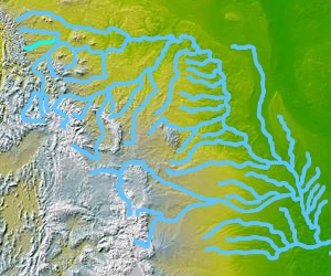
Teton River (Marias River)
| Teton River | ||
|
Location of the Teton River in the Missouri River system |
||
| Data | ||
| Water code | US : 792009 | |
| location | Chouteau County , Teton County in Montana (USA) | |
| River system | Mississippi River | |
| Drain over | Marias River → Missouri → Mississippi → Gulf of Mexico | |
| Confluence of |
North Fork and South Fork Teton River 47 ° 52 ′ 58 ″ N , 112 ° 37 ′ 59 ″ W |
|
| Source height | 1475 m | |
| muzzle |
Maria's River Coordinates: 47 ° 55 ′ 55 " N , 110 ° 30 ′ 32" W 47 ° 55 ′ 55 " N , 110 ° 30 ′ 32" W |
|
| Mouth height | 781 m | |
| Height difference | 694 m | |
| Bottom slope | 2.9 ‰ | |
| length | 240 km | |
| Catchment area | 5248 km² | |
| Discharge at the gauge Loma A Eo : 4920 km² Location: 1 km above the mouth |
MQ 2000/2016 Mq 2000/2016 |
1.3 m³ / s 0.3 l / (s km²) |
| Communities | Choteau | |
The Teton River is a 240 km long right tributary of the Marias River in the US state of Montana .
The headwaters of the Teton River are located in the Rocky Mountain Front in western Montana. The river arises at the confluence of its two headwaters, the North Fork Teton River (about 30 km long) and the South Fork Teton River (17 km long) at the foot of the Rocky Mountains . It flows east through the Great Plains . Above Choteau is the Eureka Reservoir , which is fed by the Teton River. The natural course of the Teton River runs south past the reservoir. The Teton River finally flows into the Marias River opposite the village of Loma , 1.5 km above its confluence with the Missouri River . The lower reaches of the Teton River runs north of the Missouri River. The catchment area of the Teton River covers 5248 km². The mean discharge at the mouth is 1.3 m³ / s.

