Pulau Tioman
| Pulau Tioman | ||
|---|---|---|
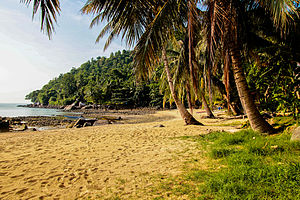
| Beach at Salang on Tioman | ||
| Waters | South China Sea | |
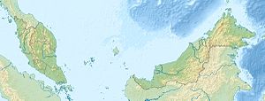
| Geographical location | 2 ° 49 ′ N , 104 ° 11 ′ E | |
|
|
||
| length | 39 km | |
| width | 12 km | |
| surface | 110 km² | |
| Highest elevation | Gunung Kajang 1038 m |
|
| Residents | 432 (2008) 3.9 inhabitants / km² |
|
| main place | Kampung Tekek | |
Pulau Tioman is a Malay island in the South China Sea . It is located about 50 km east of the mainland of the Malay Peninsula . There are several villages on Tioman, most of which consist of small, simple huts for tourists and can only be reached by water or hiking trails through the jungle.
On the island, which is part of the state of Pahang , there is only one road and few cars and motorcycles. The island's small airport closed in 2014. The island can be reached with one of the numerous ferries that commute between Tioman and Mersing all day ( monsoon time: once a day). There are regular bus connections from Kuala Lumpur, Johor Bahru and Singapore to the ferry terminal in Mersing . However, a direct ferry connection with Singapore has been discontinued.
The interior of the 39 km long and 12 km wide island is a nature reserve , covered with tropical jungle. The highest point is Gunung Kajang Mountain (1038 m). Around the island there are some diving areas that are quite interesting, but not comparable with the areas on the Maldives or the Red Sea . There are also some WWII wrecks nearby, such as the HMS Prince of Wales or the HMS Repulse . These lie at a depth of 50 - 70 meters and are therefore reserved for technical divers .
history
Due to its high mountains and its location 30 km off the coast, Tioman has long been an important stopover for trade from Thailand to the Indonesian islands such as Java. Already in the Arabic book Akbar as Sin wa'l Hind (English history from China and India ) written 1000 AD, the island is mentioned as a source of fresh water. Chinese sources such as the Wubeizhi maps (around 1620) also show the island. They are based on reports from Zheng He , who is said to have also visited the island. It is also known that Portuguese and Dutch ships stopped here from the 15th century, and that Willem Jansz was here in 1602 on the way from China to Bantam. The island can later be found on Jan van Doetichum's Dutch maps . In 1693 Engelbert Kaempfer also worked as an accountant at De Waelstrom .
Others
The island became famous for the Hollywood film South Pacific , which was shot there in 1958.


