Todscha Basin
Coordinates: 52 ° 36 ′ 15 ″ N , 96 ° 38 ′ 58 ″ E
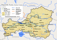
The Todscha Basin ( Russian Тоджи́нская котлови́на , also Todscha Basin ) is located in the northeast of the Russian Republic of Tuva in the south of Siberia .
The basin landscape extends in the Todschinsky administrative district . It is drained by the two right tributaries of the Great Yenisei , Chamsara and Toora-Chem . The Todscha Basin is framed by the East Sayan in the north and the Akademika-Obrucheva Mountains in the south. The longitudinal extension is about 150 km. The height varies between 800 m in the west and 1800 m in the east. The relief shows low mountains with low mountain character . In the west there is hilly plains. Numerous lakes (the largest are the Todscha Lake , the Many-Chol and the Kadysch ) occur in the Todscha Basin. The vegetation consists mainly of taiga ( larches , Siberian stone pines and spruces ). In the western part of the Todscha Basin there are birch forests and sedge vegetation .
Web links
Individual evidence
- ↑ a b c d e Article Todscha Basin in the Great Soviet Encyclopedia (BSE) , 3rd edition 1969–1978 (Russian)

