Tomlishorn
| Tomlishorn | ||
|---|---|---|
|
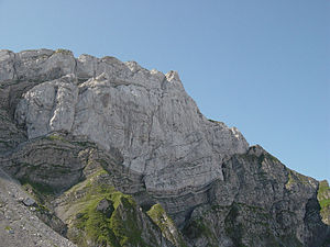
The Tomlishorn from the north. The old Tomliweg leads from the left over the ribbons to the summit. |
||
| height | 2128.5 m above sea level M. | |
| location | Cantonal border Obwalden / Nidwalden , Switzerland | |
| Mountains | Pilatus massif | |
| Dominance | 16.7 km → Widderfeld Stock | |
| Notch height | 585 m ↓ Faith Mountain | |
| Coordinates | 661 062 / 202 847 | |
|
|
||
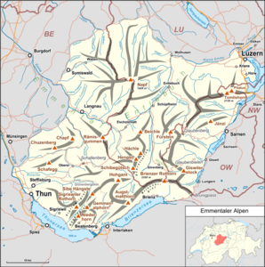
The Tomlishorn ( 2128.5 m above sea level ) is the highest peak of the Pilatus massif in the Emmental Alps near Lucerne in Switzerland . It is easy to reach from the mountain station of the Pilatus lifts (Pilatus Kulm) and is a good vantage point.
reachability
From the Hotel Bellevue at the Pilatus Kulm mountain station, a largely paved path with railings leads south, just below the main ridge, and finally winds in a few bends to the culmination point.
A variant is the shady, rather alpine ascent from the Eigental to the north or from the Klimsenhorn via the old Tomliweg. The path leads past Chastelendossen to the north face of the Tomlishorn. There you cross into the wall to the west on relatively narrow bands. With the help of wire ropes, you finally get to the exit via a ramp and thus to the ridge between the Tomlishorn and the Gemsmättli (to Matte in the sense of Wiese ; also written Gemsmettli ). The summit can be reached via the ridge route. The old Tomliweg was laid out in 1862 by the well-known hotelier from Klimsensattel , the builder Kaspar Blättler , and provided with stairs and railings. Over the years the trail had disintegrated until it was restored as an alpine trail by the Pro Pilatus Association .
etymology
"Tomlis" developed from the Latin tumulus = rounded arch . The Tomlishorn is sometimes called the Tumlishorn in the local language . How the vowel change came about is unclear.
geology
The summit is built up by the lower Schrattenkalk of the southern limb of the Tomli horn fold. A fraction creates a doubling of the Schrattenkalk. When climbing up the old Tomliweg in the north face, you first cross the Drusberg / Schrattenkalk layer boundary (bands) and then climb along the fault zone ( Kieselkalk / Schrattenkalk) over the ramp to the exit.
outlook
literature
- Alfred Helfenstein: The name of the Pilatus area , Keller & Co AG, Lucerne 1982, ISBN 3-85766-004-X .
- Josef Aregger: The Pilatus - historical and natural science , separate print from the negotiations of the Swiss Natural Research Society. Lucerne 1972.
- August Buxtorf: Geology of Pilatus , lecture given at the 105th annual meeting of the Swiss Natural Research Society in Lucerne on October 1, 1924. Buchdruckerei Büchler & Co., Bern 1924.
- Peter Xaver Weber: Pilatus and its history. Eugen Haag publishing house, Lucerne 1913.
Individual evidence
- ↑ Alfred Helfenstein: The Namengut Pilate territory. Keller, Luzern 1982 ISBN 3-85766-004-X , pp. 24 and 48.


