Trumbull (Connecticut)
| Trumbull | ||
|---|---|---|
|
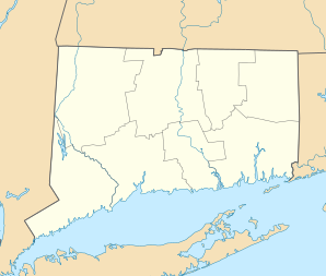
Location in Connecticut
|
||
| Basic data | ||
| Foundation : | 1639 | |
| State : | United States | |
| State : | Connecticut | |
| County : | Fairfield County | |
| Coordinates : | 41 ° 14 ′ N , 73 ° 13 ′ W | |
| Time zone : | Eastern ( UTC − 5 / −4 ) | |
| Residents : | 35,299 (as of 2005) | |
| Population density : | 585.4 inhabitants per km 2 | |
| Area : | 60.9 km 2 (approx. 24 mi 2 ) of which 60.3 km 2 (approx. 23 mi 2 ) is land |
|
| Height : | 81 m | |
| Postal code : | 06611 | |
| Area code : | +1 203 | |
| FIPS : | 09-77200 | |
| GNIS ID : | 0213518 | |
| Website : | www.trumbull-ct.gov | |
Trumbull is a town in Fairfield County in the US -amerikanischen State Connecticut with 35,100 inhabitants (2004). The geographical coordinates are: 41.26 ° North, 73.21 ° West. The urban area has a size of 60.9 km².
sons and daughters of the town
- Benjamin Silliman (1779–1864), chemist
- Chris Soule (* 1973), skeleton driver
- Chris Drury (* 1976), ice hockey player and official
Web links
Commons : Trumbull (Connecticut) - collection of pictures, videos and audio files
- Official website of the city of Trumbull
