Chichachev comb
| Chichachev comb | ||
|---|---|---|
| Highest peak | Turgen Uul ( 4029 m ) | |
| location |
Altai Republic , Tuva ( Russia ), Mongolia |
|
| part of | Altai Mountains | |
|
|
||
| Coordinates | 49 ° 48 ' N , 89 ° 45' E | |
| rock | Sandstone , limestone , mica slate , quartzite | |
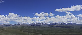
The Tschichatschow-comb ( Russian Хребет Чихачёва ) lies in the southeastern Altai Mountains in the "triangle" of Mongolia and the Russian republics of Altai and Tuva .
The mountain range has a length of about 100 km. The highest point is the 4029 m high Turgen Uul in Mongolia . In the southwest the mountain range merges into the Sailjugem . The Schapschal ridge joins in the north . To the west lies the Chuja steppe . The mountains consist of sandstone , limestone , crystalline mica schist and quartzite . Only a small part of the Tschichachev ridge is glaciated . The mountain slopes are covered by a steppe of grass and wormwood, as well as a stony tundra landscape . The mountain range was named in honor of the Russian explorer Pyotr Alexandrovich Tschichachev .
Web links
- Topographic map (southwest part)
Individual evidence
- ↑ a b c Article Tschichatschow-Kamm in the Great Soviet Encyclopedia (BSE) , 3rd edition 1969–1978 (Russian)

