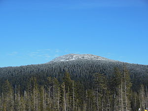
Tumalo Mountain
| Tumalo Mountain | ||
|---|---|---|
|
Tumalo Mountain from Mount Bachelor seen from |
||
| height | 2370 m | |
| location | Oregon , USA | |
| Mountains | Cascade chain | |
| Coordinates | 44 ° 0 ′ 19 ″ N , 121 ° 38 ′ 29 ″ W | |
|
|
||
| Type | Shield volcano | |
Tumalo Mountain is a shield volcano in the state of Oregon , USA . Other nearby volcanoes include Mount Bachelor in the southwest and Broken Top in the northwest. About 27 km east of Tumalo Mountain is the town of Bend . It is the county seat of Deschutes County , on whose territory the volcano rises. The United States Forest Service ( Forest Service of the United States ), built in the 1930s at the summit a forest fire watchtower , but which in the 1970s was abandoned and demolished shortly thereafter.
tourism
The Cascade Lakes Scenic Byway runs just south of Tumalo Mountain. Ice-age glaciers formed the north-eastern slope of the mountain into a sloping basin, which is particularly popular with freeriders as a ski and snowboard area. A hiking trail leads to the summit on the southwest slope.

