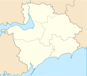
Tymoshiwka (Mychajliwka)
| Tymoshivka | ||
| Тимошівка | ||

|
|
|
| Basic data | ||
|---|---|---|
| Oblast : | Zaporizhia Oblast | |
| Rajon : | Mychajlivka district | |
| Height : | 70 m | |
| Area : | 15 km² | |
| Residents : | 3,114 (2004) | |
| Population density : | 208 inhabitants per km² | |
| Postcodes : | 72034 | |
| Area code : | +380 6132 | |
| Geographic location : | 47 ° 11 ' N , 35 ° 7' E | |
| KOATUU : | 2323388801 | |
| Administrative structure : | 1 village | |
| Address: | вул. Українська буд. 10 72030 с. Тимошівка |
|
| Website : | Community website | |
| Statistical information | ||
|
|
||
Tymoshiwka ( Ukrainian Тимошівка ; Russian Тимошовка Tymoschowka ) is a village in the Ukrainian Oblast of Zaporizhia with about 3100 inhabitants (2004).
Tymoshiwka was founded in 1809 and in 1814 already had 2,700 inhabitants. In 1839 there were 3388 inhabitants in the village. The village was occupied by the Wehrmacht between October 4, 1941 and October 27, 1943 . Tymoshiwka forms its own district council in Mychajliwka Rajon . The village is 14 km southwest of Mychajliwka district center, 36 km northeast of Wessele and 92 km south of the Zaporizhia Oblast center . Territorial road T – 08–18 runs through Tymoshiwka .
Web links
Commons : Tymoshiwka - collection of images, videos and audio files
- Municipal Council website on rada.info (Ukrainian)
Individual evidence
- ↑ The village's website on the Verkhovna Rada website , accessed on July 5, 2015
- ^ Local history Tymoshiwka in the history of the cities and villages of the Ukrainian SSR ; accessed on May 5, 2020 (Ukrainian)
- ↑ Historical background on the official website of the village; accessed on May 6, 2020 (Ukrainian)

