Uebeschisee
| Uebeschisee | ||
|---|---|---|

|
||
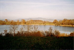
| Uebeschisee with a view to the east | ||
| Geographical location | Canton Bern | |
| Tributaries | several streams | |
| Drain | Rotmoos brook | |
| Places on the shore | Uebeschi | |
| Data | ||
| Coordinates | 609.68 thousand / 175 832 | |
|
|
||
| Altitude above sea level | 641 m above sea level M. | |
| surface | 14.21 hectares | |
| length | 375 m | |
| width | 350 m | |
| Maximum depth | 15 m | |
|
particularities |
||
The Uebeschisee is a lake in the upper Gürbetal near Thun in the canton of Bern , Switzerland .
The lake has an area of around 14 hectares and is the second largest of the Gürbetal lakes after the Amsoldingersee. It has a rounded shape and is almost 400 meters long at its greatest extent.
location
The Uebeschisee lies at 641 meters a few kilometers west of the city of Thun . It belongs to the communities Uebeschi , Stocken-Höfen and Amsoldingen , whereby Höfen has the largest share of the lake area and not the eponymous Uebeschi, with the smallest. The main tributary is the Rotebach , there are also many small tributaries; the runoff takes place via the Rotmoos brook into the Amsoldingersee located about 500 meters to the south .
Surroundings
The lake area and the shore zone are a nature reserve and are surrounded by trees, especially at the southern end. The lake area belongs to the Thun arsenal. Like the Amsoldingersee, it lies on the edge of the Alps , at the foot of the Stockhorn . From the hilly north end of the lake you have a heavenly view of the Bernese Alps , in particular the Eiger , Mönch and Jungfrau group.
