
Uebeschi
| Uebeschi | |
|---|---|
 |
|
| State : |
|
| Canton : |
|
| Administrative district : | Tuna |
| BFS no. : | 0943 |
| Postal code : | 3635 |
| Coordinates : | 608 893 / 176 541 |
| Height : | 685 m above sea level M. |
| Height range : | 633–760 m above sea level M. |
| Area : | 4.42 km² |
| Residents: | 673 (December 31, 2018) |
| Population density : | 152 inhabitants per km² |
| Website: | www.uebeschi.ch |
 Uebeschisee |
|
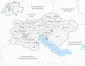
| Location of the municipality | |
  |
|
Uebeschi is a municipality in the Thun administrative district in the canton of Bern in Switzerland .
geography
The community of Uebeschi, which extends over an area of 438 hectares, is located in the moraine landscape west of Thun on the elongated hills between the Aare plain and the Stockhorn chain , an approximately 670 meter high elevation that was formed during the Ice Age . The landscape is characterized by drumlins , meadows, small trees, hedges and oaks . In between are the black and earthy former peat bogs , which were drained at the beginning of the 20th century . In higher areas the drumlins have a rock core. In the former quarry in the Gisisal Forest, there are so-called outcrops where this compact, quartz-containing sandstone is visible. From a geological point of view, the community of Uebeschi is located in a molasse basin , the so-called Helvetic Nappe .
The Uebeschisee, named after the community, is located a few hundred meters south of the village, but geographically speaking it belongs to the greater part of the communities Höfen and Amsoldingen .
history
The name of the village, a field name , cannot be clearly determined. It may be derived from the Old High German libicahe (= place where the marshmallow grows). The marshmallow is a mauve-like medicinal herb that is still called ibsche in Uebeschi today . The name may also go back to the Old High German iwa (" yew "). The following village names are documented: 1223 Ibisshe , 1236 Ibensche , 1240 Hibensche , 1242 Ybesche , 1320 Ibenschi .
The origin and meaning of the coat of arms are not known. It is first mentioned around 1780 and has been used as the municipal coat of arms since the beginning of the 20th century .
politics
The voting shares of the parties in the 2015 National Council election were: SVP 46.5%, EDU 14.5%, BDP 9.6%, SP 7.9%, EVP 5.9%, GPS 5.5%, FDP 3.2 %, glp 2.9%, CVP 1.3%, Philipp Jutzi 1.0%.
tourism
Uebeschi and the surrounding region are mainly visited by hikers and cyclists. The Way of St. James (the pilgrimage to the tomb of the Apostle James in Santiago de Compostela in Spain ) also leads through Uebeschi. The signposted path goes from Amsoldingen along the long, panoramic hill, past the Übeschisee. The route forks in front of the village. The previously marked path led to the right in the direction of Längenbühl , over the Dittligsee and Forst . The new path leads up to the left, through the village of Uebeschi and on via Honegg and then through a former moraine landscape into the Gürbetal to Blumenstein .
Personalities
- Christian Portner (1870–1951), evangelist
See also
Web links
- Official website of the Uebeschi municipality
- Anne-Marie Dubler : Uebeschi. In: Historical Lexicon of Switzerland .
Individual evidence
- ↑ Permanent resident population from STAT-TAB of the BfS , municipalities see also regional portraits 2020 on bfs.admin.ch, accessed on May 29, 2020
- ^ Results of the community of Uebeschi. State Chancellery of the Canton of Bern, October 18, 2015, accessed on October 30, 2016 .
- ^ Jakobsweg.ch , section of the route from Amsoldingen to Rüeggisberg, accessed on June 28, 2014.
Amsoldingen | Flower stone | Buchholterberg | Burgistein | Eriz | Fahrni | Forst-Längenbühl | Gurzelen | Heiligenschwendi | Heimberg | Hilterfingen | Homberg | Horrenbach beeches | Oberhofen am Thunersee | Oberlangenegg | Pohlern | Reutigen | Juicy | Sigriswil | Steffisburg | Stocken-Höfen | Teuffenthal | Thierachern | Tuna | Uebeschi | Uetendorf | Unterlangenegg | Uttigen | Wax thorn | Wattenwil | Zwieselberg
Former municipalities: Forst | Goldiwil | Höfen bei Thun | Kienersrüti | Längenbühl | Stocking down | Oberstocken | Schwendibach | Strättligen | Tannenbühl | Thung snow
Canton of Bern | Administrative districts of the canton of Bern | Municipalities of the Canton of Bern