Stockhorn
| Stockhorn | ||
|---|---|---|
|
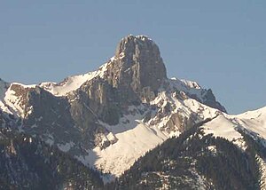
The Stockhorn of tuna viewed from |
||
| height | 2190 m above sea level M. | |
| location | Bern , Switzerland | |
| Mountains | Bernese Prealps | |
| Dominance | 9.17 km → Drunegalm | |
| Notch height | 399 m ↓ Chänelpass | |
| Coordinates | 607 562 / 171413 | |
|
|
||
|
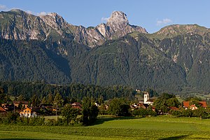
Amsoldingen with the Stockhorn chain |
||
The Stockhorn is a 2190 m high mountain in the Bernese Oberland in Switzerland .
The Stockhorn is the highest peak in the Stockhorn chain. The striking Stockhorn summit is immediately noticeable when you drive through the Gürbetal or the Aare valley towards the Bernese Oberland. Since it consists of a slab of stone set up almost vertically, it appears wide or pointed depending on the angle of view.
Stockhornbahn
Since 1969, the Stockhornbahn , a cable car with a valley station in Erlenbach im Simmental ( 725 m ), has been leading via the Chrindi intermediate station ( 1642 m ) to the summit station ( 2139 m ) just below the summit. From there you can reach the summit ( 2190 m ), or the panorama viewing platform opened in 2013 via a 70 m long, wheelchair-accessible tunnel. From the platform you can see Lake Thun, the Central Plateau and, on a clear day, the Jura , the Vosges and the Black Forest .
Mountain lakes
On the Simmental side, not far from the summit, there are two small mountain lakes, the Oberstockensee and the Hinterstockensee . They are a popular destination for amateur fishermen, as trout can be caught there.
Stockhorn marathon
The Stockhorn Half Marathon has been held every July since 2004. This run starts in Oberwil in the Simmental and ends on the Stockhorn. A height difference of 1,353 meters (+ 1,724 m / -371 m) is overcome on the 21.1 km long route.
Stockhorn chain
The pre-Alpine chain is around 13 km long and separates the Simmental in the south from the Stockental in the north in the OSE / NNW direction. It begins at Reutigen , where the Simme leaves its valley and separates the chain from the Burgfluh and the Niesen . The first prominent peak is the Simmenfluh ( 1422 m ), which with its massive appearance helps shape the region. After the Simmenfluh, the ridge descends slightly again and soon merges into a broad ridge, the Alp Heiti. A second ridge rises from the Stockental valley, which towers above the previous ridge and the Alp. The Nüschleten ( 1987 m ), the Lasenberg ( 2019 m ) and the Solhorn ( 2017 m ) are the three highest elevations on this ridge section up to the Stockhorn, which then ends in the Strüssligrat. Upstream of the Stockhorn to the north is the wide Walalpgrat ( 1920 m ), the beginning of the last ridge section of the Stockhorn chain. This is followed by the Möntschelenspitz ( 2020 m ), the Hohmad ( 2075 m ), the Stubenfluh ( 2004 m ) and the Chrummenfadenfluh ( 2074 m ). The latter actually belongs to the Gantrisch group , which is adjacent to the Stockhorn chain in the NNW.
Climbing, caves
There are several climbing gardens for sport climbers in the Stockhorn area . 120 routes in 12 sectors offer levels of difficulty from 2 to 7 in compact limestone rock around the summit and at the intermediate station.
In 1974 an extensive cave system was discovered in the area around the Oberstocken Alp. In the following years the Chäsloch, Stockenhöhle (C 8 BE) and Falkensteinhöhle were explored.
literature
- Benedictus Aretius (around 1522–1577), Stocc-Hornii et Nessi descriptio (description of the Stockhorn and Niesen mountains and the plants found there), Strasbourg 1561
Web links
- Website of the Stockhornbahn
- Pictures of the Stockhorn and its region
- Stockhorn tour reports and photos


