Valderaduey
| Río Valderaduey | ||
|
Río Valderaduey |
||
| Data | ||
| location | northern Spain | |
| River system | Duero | |
| Drain over | Duero → Atlantic Ocean | |
| source |
Iberian Mountains 42 ° 35 ′ 43 ″ N , 4 ° 56 ′ 58 ″ W |
|
| Source height | 970 msnm | |
| muzzle |
Duero coordinates: 41 ° 30 '48 " N , 5 ° 42' 30" W 41 ° 30 '48 " N , 5 ° 42' 30" W. |
|
| Mouth height | 625 msnm | |
| Height difference | 345 m | |
| Bottom slope | 2.2 ‰ | |
| length | 158 km | |
| Catchment area | 3679 km² | |
| Small towns | Villalpando | |
| Communities | Becilla de Valderaduey | |
The Río Valderaduey is an approx. 158 km long northern tributary of the Duero in the northern Spanish region of Castile and León . It was originally called Aratoi , which was later transformed into Araduey .
course
The Río Valderaduey arises from the confluence of two source streams ( Arroyo de Vallehondo and Arroyo de San Roque ) at Mount Riocamba near the village of Renedo de Valderaduey . It then runs steadily in a southerly and later south-westerly direction, flowing approx. 1.5 km away past the small towns of Sahagún and Villalpando , which are steeped in history and culture, and finally flows into the Duero approx. 2 km east of Zamora .
Tributaries
Numerous streams flow into the Río Valderaduey; the most important tributary is the Río Sequillo .
Water flow
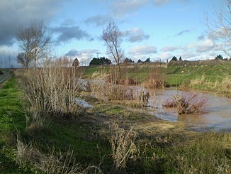
The river usually only carries water in the winter months or after heavy or long-lasting rainfall; in summer it often falls dry or swampy over long stretches.
Places on the river
Attractions
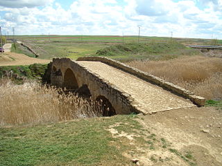
At Becilla de Valderaduey there is a medieval bridge over the river - it is often referred to as the “ Roman Bridge ”. The Way of St. James (Camino Francés) crosses the river in the town of Calzadilla de la Cueza ; there is a Romanesque chapel on the bridge .

