
Van Duzen River
| Van Duzen River | ||
 River course in the catchment area of the Eel River |
||
| Data | ||
| Water code | US : 268665 | |
| location | California (USA) | |
| River system | Eel River | |
| Drain over | Eel River → Pacific Ocean | |
| source | Southwest slope of Hettenshaw Peak in Trinity County 40 ° 15 ′ 16 ″ N , 123 ° 23 ′ 56 ″ W |
|
| muzzle | south of Fortuna in the Eel River Coordinates: 40 ° 32 ′ 40 ″ N , 124 ° 9 ′ 22 ″ W 40 ° 32 ′ 40 ″ N , 124 ° 9 ′ 22 ″ W |
|
| Mouth height |
10 m
|
|
| length | 96 km | |
| Catchment area | approx. 1113 km² | |
| Discharge at Bridgeville A Eo gauge : 575 km² |
MQ 1951/2016 Mq 1951/2016 |
24 m³ / s 41.7 l / (s km²) |
| Right tributaries | Yager Creek | |
| Communities | Bridgeville, Dinsmore | |
| National Wild and Scenic River | ||
 old bridge over the Van Duzen River near Bridgeville |
||
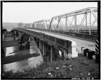 Bridge over the Van Duzen River on US Highway 101 |
||
The Van Duzen River is a right tributary of the Eel River in the northwest of the US state California . The 96 km long river drains an area of about 1113 km².
The Van Duzen River rises on the southwest slope of Hettenshaw Peak in Trinity County . It meanders through the California Coast Mountains in a predominantly northwestern direction . The State Route 36 follows the river. The towns of Dinsmore and Bridgeville as well as the Grizzly Creek Redwoods State Park are on the Van Duzen River. The river finally flows into the Eel River in Humboldt County south of Fortuna , about 20 km from the Pacific coast . The US Highway 101 crosses the river shortly before the mouth.
The Van Duzen River is one of the few rivers in California that does not have dams. The river provides habitat for various migratory fish such as king salmon , silver salmon , steelhead trout and cutthroat trout .
On January 19, 1981, a total of 640 km in the river system of the Eel River was designated as a National Wild and Scenic River . The Van Duzen River below the Dinsmore Bridge was placed under protection.
Individual evidence
- ↑ a b c Van Duzen River in the Geographic Names Information System of the United States Geological Survey
- ^ A b Coastal Watershed Planning and Assessment Program: Van Duzen River . US EPA. Retrieved August 13, 2017.
- ↑ USGS 11478500 VAN DUZEN R NR BRIDGEVILLE APPROX
- ↑ a b National Wild and Scenic Rivers System: Eel River, California