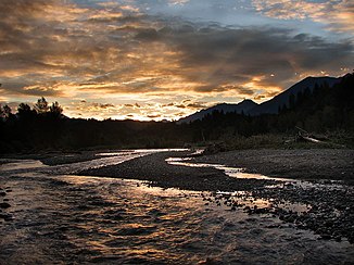
Vedder River
|
Vedder River Chilliwack River |
||
|
Evening on the Vedder River |
||
| Data | ||
| Water code | US : 1517707 | |
| location |
Washington ( USA ), British Columbia ( Canada ) |
|
| River system | Fraser River | |
| Drain over | Sumas River → Fraser River → Pacific Ocean | |
| source | as the Chilliwack River at Hannegan Pass in Whatcom County 48 ° 53 ′ 3 ″ N , 121 ° 31 ′ 42 ″ W |
|
| muzzle | in the Sumas River coordinates: 49 ° 7 '38 " N , 122 ° 5' 56" W 49 ° 7 '38 " N , 122 ° 5' 56" W.
|
|
| length | 80 km | |
| Catchment area | 1230 km² | |
| Left tributaries | Neskawatsch Creek , Slesse Creek , Sweltzer River | |
| Flowing lakes | Chilliwack Lake | |
|
The Vedder River around 1910 |
||
|
Campsite on the Vedder River |
||
The Vedder River , also known as the Chilliwack River , is a river in the Canadian province of British Columbia and the US state of Washington .
The name Chilliwack comes from the Indian language Halkomelem , which means “valley of many rivers”.
River course
The river rises as the Chilliwack River from the Hannegan Pass in Washington's North Cascades National Park , flows north over the Canadian-American border and finally into Chilliwack Lake . The river flows, from the lower half, through Hells Gorge, a deep, dangerous and inaccessible gorge. Before the border it flows together with the Little Chilliwack River . There is a small sandy beach at the point where it flows into the lake. It leaves the lake in the north and flows through the Chilliwack River Valley to leave the Fraser Lowland , on the south side of Chilliwack . At Vedder Crossing the river joins the Sweltzer River , flows through a bridge and becomes the Vedder River. The river then flows northwest into the Sumas River to merge with the Fraser River at the northeast end of the Sumas Mountains . Between Vedder Crossing and the confluence with the Sumas River, the river crosses the Fraser floodplains , which protect the surrounding towns and fields from flooding and is part of the irrigation system that transformed Sumas Lake into Sumas Prairie .
Downstream of the Vedder Crossing Bridge, the Vedder River marks the boundary between Yarrow and Greendale .
history
Before heavy rain in 1875, the Chilliwack River, north of Vedder Crossing, flowed over a wide alluvial cone, then was divided into Vedder Creek and Luckakuk Creek by an obstacle. This created poverty among farmers in the area. In 1882 a new barrier was erected which shifted the various streams westward and which now ran into the now drained Sumas Lake. A flood in 1894 consolidated the new course. In the early 20th century, the divided river was diked and canalized. Nowadays, the Chilliwack River at Vedder Crossing changes its name to Vedder River and further downstream becomes the Vedder Canal. The Vedder Canal was built in 1920 as part of an effort to keep Sumas Lake dry. The former course of the Chilliwack River, behind Vedder Crossing, is now known as Chilliwack Creek and flows north into the Fraser River.
The Chilliwack River was used by the Northwest Boundary Survey from 1857 to 1862 as a means of accessing the 49th parallel and thus measuring the border between America and Canada. The tributaries Liumchen Creek, Tamihi Creek, Damfino Creek, Slesse Creek, Nesakwatch Creek, Klahailhu Creek and Depot Creek cross the 49th parallel. The American and British Land Surveyors established bases from which expeditions towards the arid Chilliwack and Skagit River areas were started. The Whatcom Trail followed the main part of the Chilliwack River.
use
The Vedder River Campground, operated by Cultus Lake Parks, is open all year round.
The Vedder-Chilliwack River for the migration of king salmon , silver salmon , humpback salmon , sockeye salmon and rainbow trout known.
The 1954 British Empire and Commonwealth Games rowing championships were held on the Vedder Canal.
Tributaries
Tributaries in the United States
- Indian Creek
- Bear Creek
- Little Chilliwack River
Tributaries in Canada
- Center Creek
- Nesakwatch Creek
- Foley Creek
- Chipmunk Creek
- Slesse Creek
- Tamihi Creek
- Liumchen Creek
- Sweltzer River
Web links
- Vedder River . In: BC Geographical Names (English)
- Vedder River, Yarrow, BC


