
Virgin Gorda
| Virgin Gorda | ||
|---|---|---|
 |
||
| Waters | Caribbean Sea | |
| Archipelago | Virgin Islands | |
| Geographical location | 18 ° 28 ′ N , 64 ° 24 ′ W | |
|
||
| length | 15.9 km | |
| width | 4.9 km | |
| surface | 21.9 km² | |
| Highest elevation | Gorda Peak 418 m |
|
| Residents | 3930 (2010) 179 inhabitants / km² |
|
| main place | Spanish Town | |

Virgin Gorda is square kilometers with an area of approximately 22 after Tortola and Anegada the third largest British Virgin Islands ( English British Virgin Islands, BVI ). According to the 2010 census, the island has 3930 inhabitants. The main town with about 1000 inhabitants (2006) is Spanish Town . The highest point on the island is Gorda Peak with a height of 418 m .
Christopher Columbus called the island "The Fat Virgin" because its silhouette resembles a plump woman lying on her back.
Swimming and snorkeling and, more recently, bouldering are the main attractions of tourism. A draw for visitors are the unusual geological formations in the southwest known as The Baths . There huge blocks of granite form grottos that open towards the sea.
Virgin Gorda is a popular destination for sailors, so there are several marinas here . In the northeast of the island is the Bitter End Yacht Club Marina with 70 moorings . The Gorda Yacht Harbor in Spanish Town is on the west coast. Yachts with a length of up to 49 meters and a draft of up to 3 meters can moor here. There is also a boatyard for repair and maintenance work.
Also of importance are the ruins of the old copper mine , which was operated in the south-east of the island in the middle of the 19th century with the help of miners from Cornwall .
There is a small airfield east of Spanish Town .
gallery

Impression
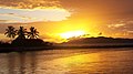
sunset

Mangrove Beach


Web links
- Our Islands. Virgin Gorda. Government of the Virgin Islands(English).
- Virgin Gorda. In: The British Virgin Islands. British Virgin Islands Tourist Board
- Virgin Gorda in the British Virgin Islands. In: British Virgin Islands. Bareboats BVI, January 5, 2015(English).
Individual evidence
- ^ Areas of the British Virgin Islands ( Memento of April 4, 2007 in the Internet Archive ), accessed on January 1, 2018.
- ^ Virgin Islands 2010 Population and Housing Census Report. (PDF; 2.52 MB) Executive Summary. Government of the Virgin Islands - Central Statistics Office, December 1, 2016, p. 1 , accessed January 1, 2018 .
- ↑ Gorda Peak National Park. In: The British Virgin Islands. British Virgin Islands Tourist Board, accessed January 1, 2018 .
- ^ The Baths - Virgin Gorda. In: British Virgin Islands. Bareboats BVI, January 5, 2015, accessed January 1, 2018 .
- ↑ marinas. Bitter End Yacht Club Marina. In: The British Virgin Islands. British Virgin Islands Tourist Board, accessed January 1, 2018 .
- ↑ marinas. Virgin Gorda Yacht Harbor. In: The British Virgin Islands. British Virgin Islands Tourist Board, accessed January 1, 2018 .
- ↑ The Copper Mine Ruins, Virgin Gorda. In: British Virgin Islands. Bareboats BVI, January 5, 2015, accessed on March 16, 2020 .