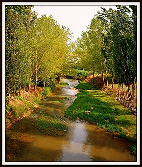
Vixiège
| Vixiège | ||
|
The Vixiège in Belpech |
||
| Data | ||
| Water code | FR : O16-0400 | |
| location | France , Occitania region | |
| River system | Garonne | |
| Drain over | Hers-Vif → Ariège → Garonne → Atlantic Ocean | |
| source | in the municipality of Saint-Gaudéric, 43 ° 6 ′ 49 ″ N , 1 ° 58 ′ 46 ″ E |
|
| Source height | approx. 420 m | |
| muzzle | below Belpech in the Hers-Vif coordinates: 43 ° 12 '20 " N , 1 ° 44' 49" E 43 ° 12 '20 " N , 1 ° 44' 49" E |
|
| Mouth height | approx. 230 m | |
| Height difference | approx. 190 m | |
| Bottom slope | approx. 5.6 ‰ | |
| length | approx. 34 km | |
The Vixiège is a river in France that runs in the Aude department , in the Occitanie region . Its source stream Ruisseau de Dabant rises in the municipality of Saint-Gaudéric and initially drains north-east to north. Later, the Vixiège turns west to northwest and flows into the Hers-Vif as a right tributary about 34 kilometers below Belpech .
