Vulcan (Michigan)
| Vulcan | ||
|---|---|---|
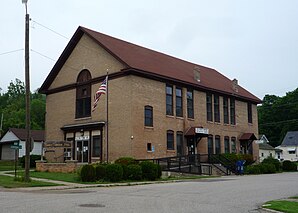
 Vulcan Town Hall |
||
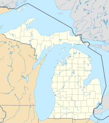
| Location in Michigan | ||
|
|
||
| Basic data | ||
| State : | United States | |
| State : | Michigan | |
| County : | Dickinson County | |
| Coordinates : | 45 ° 47 ′ N , 87 ° 52 ′ W | |
| Time zone : | Central ( UTC − 6 / −5 ) | |
| Height : | 291 m | |
| Postal code : | 49870 | |
| Area code : | +1 906 | |
| FIPS : | 26-82640 | |
| GNIS ID : | 1615636 | |
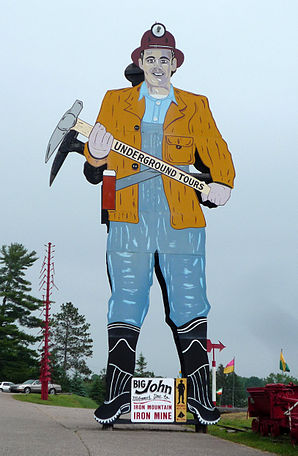
 Big John ("The World's Largest Miner") |
||
Vulcan is a settlement on community-free area in Dickinson County in the US -amerikanischen State Michigan .
geography
Vulcan is located in the west-central part of Michigan's Upper Peninsula . The Menominee River flows around 3 km south of Vulcan and forms the border with Wisconsin until it flows into Lake Michigan . The city of Norway is on the western border , Iron Mountain is a few kilometers to the west.
The geographical coordinates of Vulcan are 45 ° 46'50 "north latitude and 87 ° 51'45" west longitude. Vulcan is the only settlement within Norway Township .
traffic
The US Highway 2 runs in west-east direction by Vulcan. All other roads are subordinate country roads, some unpaved roads and inner-city connecting roads.
A Canadian National Railway runs parallel to US 2 .
The nearest regional airport is Ford Airport in Iron Mountain, 13 miles west.
history
A mining company set up shop here on September 12, 1877, after exploration work by the Milwaukee Iron Company led to the establishment of the famous Vulcan Mine in 1872 . The village of the same name developed from this. The former mine is now used as a show mine where guided tours are offered.
Known residents
- Charlotte Armstrong , American crime writer, was here on 2. May 1905 born
Individual evidence
- ↑ Michigan Department of Transportation - Railroad Map (PDF; 1 MB) Retrieved May 23, 2014
- ↑ Iron Mountain Iron Mine. Retrieved May 21, 2014
