Norway Township (Michigan)
| Norway Township | ||
|---|---|---|
|
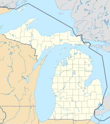
Location in Michigan
|
||
| Basic data | ||
| State : | United States | |
| State : | Michigan | |
| County : | Dickinson County | |
| Coordinates : | 45 ° 49 ′ N , 87 ° 53 ′ W | |
| Time zone : | Central ( UTC − 6 / −5 ) | |
| Residents : | 1,489 (as of 2010) | |
| Population density : | 6.4 inhabitants per km 2 | |
| Area : | 235.4 km 2 (approx. 91 mi 2 ) of which 231.3 km 2 (approx. 89 mi 2 ) are land |
|
| Height : | 321 m | |
| Postal code : | 49870 | |
| Area code : | +1 906 | |
| FIPS : | 26-59240 | |
| GNIS ID : | 1626822 | |
| Website : | www.norwaytownship.com | |
| Mayor : | Leonard Bal (supervisor) | |
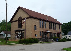
 Vulcan Town Hall in Norway Township |
||
The Norway Township is one of seven townships in Dickinson County in the US -amerikanischen State Michigan . In 2010 Norway Township had 1,489 inhabitants.
geography
Norway Township is located in the west-central part of the Upper Peninsula of Michigan on the Menominee River , which forms the border with Wisconsin up to its confluence with Lake Michigan . The township borders on the city of the same name, Norway , without it being part of the township. The town of Iron Mountain is a few miles to the west.
traffic
The US Highway 2 runs in east-west direction through the Township. All other roads are subordinate country roads, some unpaved roads and inner-city connecting roads.
A Canadian National Railway runs parallel to US 2 for freight traffic .
The nearest regional airport is Ford Airport in Iron Mountain, around 25 km to the west.
history
A mining company set up shop here on September 12, 1877, after exploration work by the Milwaukee Iron Company led to the establishment of the famous Vulcan Mine in 1872 . From this, Vulcan soon developed into the only village within the township.
population
According to the 2010 census , the Town of Norway had 1,489 people in 623 households. The population density was 6.4 people per square kilometer. Statistically, 2.36 people lived in each of the 623 households.
The racial the population was composed of 98.6 percent white, 0.1 percent African American, 0.3 percent Asian and 0.1 percent from other ethnic groups; 0.9 percent were descended from two or more races. Hispanic or Latino of any race was 0.4 percent of the population.
19.1 percent of the population were under 18 years old, 61.6 percent were between 18 and 64 and 19.3 percent were 65 years or older. 49.0 percent of the population were female.
The average annual income for a household was 54,239 USD . The per capita income was $ 29,849. 4.0 percent of the population lived below the poverty line.
Known residents
- Charlotte Armstrong , American crime writer, was here on 2. May 1905 born
Individual evidence
- ↑ a b American Fact Finder. Retrieved May 21, 2014
- ↑ Michigan Department of Transportation - Railroad Map (PDF; 1 MB) Retrieved May 23, 2014
