Nahr ez-Zarqa
|
Nahr ez-Zarqa Jabbok |
||
|
The catchment area of the Nahr ez-Zarqa |
||
| Data | ||
| location | Jordan | |
| River system | Jordan | |
| Drain over | Jordan → Dead Sea | |
| source | in the mountains northeast of Amman | |
| Source height | 776 m | |
| muzzle | at Damiya in the Jordan Coordinates: 32 ° 6 '55 " N , 35 ° 32' 35" E 32 ° 6 '55 " N , 35 ° 32' 35" E |
|
| Mouth height | 313 m below sea level | |
| Height difference | 1089 m | |
| Bottom slope | 17 ‰ | |
| length | 65 km | |
| Catchment area | 3900 km² | |
| Reservoirs flowed through |
Koenig Talal Dam 32 ° 11 ′ 30 ″ N , 35 ° 48 ′ 6 ″ E |
|
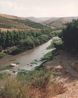
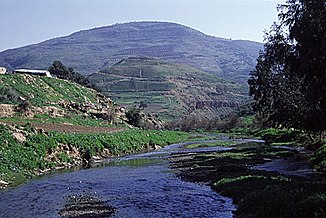
The Nahr ez-Zarqa ( Arabic نهر الزرقاء, DMG Nahru z-Zarqāʾ ' blue river'; German also Jabbok ) is a river in Jordan . It rises a few kilometers northeast of Amman at the prehistoric settlement ʿAin Ghazal and flows first in a northerly direction before it bends to the west, is dammed by the König Talal dam and finally flows into the Jordan .
The Nahr ez-Zarqa is mentioned several times in the Old Testament under the name Jabbok . It flowed through the Gilead mentioned in the Bible and separated the areas of the tribes Reuben and Gad from the kingdom of the Ammonites to the south . The land of Sihon extended “from the Arnon to the Jabbok” and was later claimed by the King of Ammon ( Num 21.24 EU ; Dtn 2.37 EU ; 3.16 EU ; Jos 12.2 EU ; Ri 11.13 EU . 22 EU ).
The lower course of the Jabbok gained special importance because according to Gen 32,23–33 EU the fight of Jacob with God or the angel representing him ( Hos 12,4f EU ) is said to have taken place on its bank .
Web links
- Zarqa River (English)
literature
- Georg Beer : Jabbok . In: Paulys Realencyclopadie der classischen Antiquity Science (RE). Volume IX, 1, Stuttgart 1914, Col. 543.


