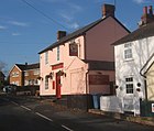
Washbrook
| Washbrook | |||
|---|---|---|---|
|
|
|||
| Coordinates | 52 ° 2 ′ N , 1 ° 5 ′ E | ||
|
|
|||
| Residents | 517 (as of 2011) | ||
| administration | |||
| Part of the country | England | ||
| region | East of England | ||
| Shire county | Suffolk | ||
| District | Babergh | ||
| Civil Parish | Copdock and Washbrook | ||
Washbrook is a village in Civil Parish Copdock and Washbrook in District Babergh in the county of Suffolk , England. Washbrook is 3 miles from Ipswich . In 2011 it had a population of 517 residents. Due to an ordinance issued in November 1993, Washbrook was merged with the adjoining Copdock to the south on April 1, 1994 to form the new Parish Copdock and Washbrook.
Individual evidence
- ↑ Office for National Statistics: Washbrook Built-up area ( English ) Noims. Retrieved January 25, 2020.
- ↑ Local Government Boundary Commission for England: The Babergh (Suffolk) (Parishes) Order 1993 ( English ) Retrieved January 25, 2020.


