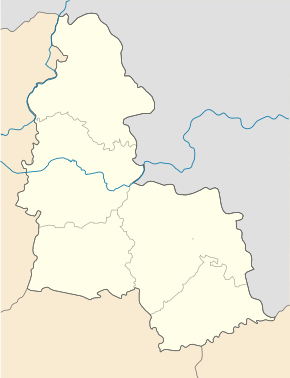
Vasylivka (Lebedyn)
| Vasylivka | ||
| Василівка | ||

|
|
|
| Basic data | ||
|---|---|---|
| Oblast : | Sumy Oblast | |
| Rajon : | Lebedyn district | |
| Height : | 125 m | |
| Area : | Information is missing | |
| Residents : | 1,550 (2001) | |
| Postcodes : | 42231 | |
| Area code : | +380 5445 | |
| Geographic location : | 50 ° 40 ' N , 34 ° 11' E | |
| KOATUU : | 5922981601 | |
| Administrative structure : | Villages, 1 settlement | |
| Address: | вул. Полтавська буд. 1 42231 с. Василівка |
|
| Website : | City council website | |
| Statistical information | ||
|
|
||
Vasylivka ( Ukrainian Василівка ; Russian Василевка Wassylewka ) is a village in the Ukrainian Sumy 1550 inhabitants (2001).
The village, founded in the 1680s, is the administrative center of the district council of the same name in the northwest of Lebedyn district on the border with Lypowa Dolyna district .
In addition to Vasylivka, the municipality also includes the villages Novossilske ( Новосільське , ⊙ ) with about 40 inhabitants and Pomirky ( Помірки , ⊙ ) with about 120 inhabitants and the settlement Myrne ( Мирне , ⊙ ) with about 80 inhabitants.
The village is located at an altitude of 125 m on the bank of the Hrun ( Грунь ), an 85 km long right tributary of the Psel , 25 km northwest of the Lebedyn district and 58 km southwest of the Sumy oblast center .
Individual evidence
- ↑ Local website on the official website of the Verkhovna Rada ; accessed on October 24, 2019 (Ukrainian)
- ^ Local history Wassyliwka in the history of the cities and villages of the Ukrainian SSR ; accessed on October 24, 2019 (Ukrainian)
- ^ Website of the district council on the official website of the Verkhovna Rada; accessed on October 24, 2019 (Ukrainian)


