Weißenfluh
| Weißenfluh | ||
|---|---|---|
|
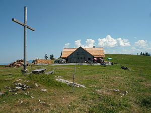
The Weißenfluhalpe with the alpine cross |
||
| height | 1367 m above sea level A. | |
| location | Vorarlberg , Austria | |
| Mountains | Bregenz Forest Mountains | |
| Dominance | 1.5 km → slope peak | |
| Notch height | 115 m ↓ Weißenfluhsattel to the Gräsakopf | |
| Coordinates | 47 ° 22 '44 " N , 9 ° 49' 46" E | |
|
|
||
| Normal way | Hiking trail from the Bödele via the Lustenauer and Bregenz huts | |
The Weißenfluh is 1367 m above sea level. A. high peak in the Bregenz Forest Mountains in Austria . Directly at the summit of the mountain is the Weißenfluhaple, a cultivated alp in the municipality of the city of Dornbirn . The summit and alp are located in a clearing in the otherwise densely overgrown coniferous forest . The mountain can be hiked on an easy path and is also popular with mountain bikers.

