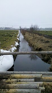
Weiherbach (Bohemian Pond)
| Weiherbach | ||
| Data | ||
| location | Bavaria | |
| River system | Danube | |
| Drain over | Böhmerweiher → Weihergraben → Gröbenbach → Amper → Isar → Danube | |
| source |
Speckbach 48 ° 10 ′ 9 ″ N , 11 ° 22 ′ 37 ″ E |
|
| Source height | approx. 517 m above sea level NHN | |
| muzzle | Weihergraben Coordinates: 48 ° 10 ′ 38 " N , 11 ° 22 ′ 41" E 48 ° 10 ′ 38 " N , 11 ° 22 ′ 41" E
|
|
| length | 1.1 km | |
The Weiherbach is a 1.1 km long brook in the western part of Munich . It belongs to the Isar river system .
The moat of the Weiherbach is fed by the Speckbach , flows through one of the Bohemian ponds and then flows into the Weihergraben, shortly before its inflow into the Gröbenbach .
Web links
- The course of the Weiherbach on the BayernAtlas
