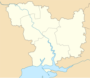
Velyka Mechetnya
| Velyka Mechetnya | ||
| Велика Мечетня | ||

|
|
|
| Basic data | ||
|---|---|---|
| Oblast : | Mykolaiv Oblast | |
| Rajon : | Krywe Osero district | |
| Height : | 111 m | |
| Area : | 4.543 km² | |
| Residents : | 1,353 (2001) | |
| Population density : | 298 inhabitants per km² | |
| Postcodes : | 55130 | |
| Area code : | +380 5133 | |
| Geographic location : | 48 ° 5 ' N , 30 ° 35' E | |
| KOATUU : | 4823981001 | |
| Administrative structure : | 3 villages, 2 settlements | |
| Address: | вул. Голімбієвського, буд. 69 55 130 с. Велика Мечетня |
|
| Website : | City council website | |
| Statistical information | ||
|
|
||
Welyka Metschetnja ( Ukrainian Велика Мечетня ; Russian Великая Мечетня Velikaja Metschetnja , Polish Meczetna Wielka ) is a village on the right bank of the Southern Bug in the northwest of the Ukrainian Oblast Mykolaiv with about 1300 inhabitants (2001).
The end of the 18th century by fugitive serfs from the Vltava River and founded the Ukrainian village is the administrative center of the eponymous district municipality in northeastern Rajon Krywe Ozero to which even the villages Ternuwate ( Тернувате , ⊙ ) with about 390 inhabitants and Tokariwka ( Токарівка , ⊙ ) with about 170 inhabitants as well as the settlements Iwaniwka ( Іванівка , ⊙ ) with about 20 inhabitants and Kuprijaniwka ( Купріянівка , ⊙ ) with about 10 inhabitants.
The village is located at an altitude of 111 m , 26 km northeast of the district center Krywe Osero and 185 km northwest of the Oblast center Mykolaiv .
Web links
- Meczetna Wielka . In: Filip Sulimierski, Władysław Walewski (eds.): Słownik geograficzny Królestwa Polskiego i innych krajów słowiańskich . tape 6 : Malczyce – Netreba . Walewskiego, Warsaw 1885, p. 224 (Polish, edu.pl ).
Individual evidence
- ↑ Local website on the official website of the Verkhovna Rada ; accessed on October 29, 2019 (Ukrainian)
- ^ Local history Velyka Metschetnja in the history of the cities and villages of the Ukrainian SSR ; accessed on October 29, 2019 (Ukrainian)
- ^ Website of the district council on the official website of the Verkhovna Rada; accessed on October 29, 2019 (Ukrainian)

