Wienerberg City

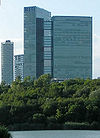
The Wienerberg City is a neighborhood in the 10th district of Vienna favorites . It is located on the ridge of the Wienerberg and, along with Donau City, forms the largest skyscraper cluster in Vienna.
history
The history of the area as a brick factory can be found in the history of the Wienerberg (see there). The first step towards (high-rise) urbanization was then taken by the Philips house built by architect Karl Schwanzer . For decades, the former Philips Austria headquarters on Wienerberg was a solitary eye-catcher for travelers coming to Vienna from the south. The building, which has been vacant since the end of 2013, was bought by the 6B47 Group and the Sans Souci private foundation in 2013 and will be converted into an apartment building by 2016.
Urban planning ideas competition
At the beginning of the 1980s, an urban planning ideas competition took place for the area of the Wienerberg, which was then uncultivated. This formed the prelude to the design of today's near-natural recreational area with an area of 117 hectares . In 1995, 90 hectares of the total area were placed under nature protection. In 1999, construction began on Wienerberg City - a collection of residential towers and high-rise office buildings - and a new brick pond. The first building of this type to be completed on the ridge of the Wienerberg was the Vienna Twin Tower in 2001. The project was to cost more than 220 million euros in the following years, but it was not without controversy. Urban planner Reinhard Seiß criticized, among other things, the inadequate connection to public transport.
present
concept
According to the concept, Wienerberg City should be "a modern and new district", which should offer new living and workplaces and, with its close proximity to the Wienerberg recreation area, promise its users and residents a high quality of life . This should be rounded off by the good transport links.
General
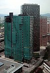
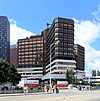
The total usable area (including sidewalks, green spaces, water areas, etc.) of today's district is around 230,000 m², of which around 130,000 m² are office and retail space. There are a total of eight buildings in Wienerberg City, three of which are more than 100 meters high. There is a cinema, the Cineplexx Wienerberg , a shopping mall , the 4 star Hotel “Holiday Inn”, an elementary school and two kindergartens on the premises. There are around 1000 parking spaces in the area, which are laid out as an extensive underground car park system. The Business Park Vienna is part of Wienerberg City .
Transport links
Wienerberg City is a two-minute drive from the A2 / A21 / A23 / S1 motorway junction and is right next to Triester Strasse and Wienerbergstrasse , which means it is well connected to the Vienna road network. In addition, a separate shuttle bus (7B) is available Monday to Friday for residents and users of the high-rise cluster, which stops directly in Wienerberg City and transports its passengers to Meidling station . Wienerberg City is also served by bus routes 7A, 15A and 63A and 65A and the night bus route N62.
Metro station
In the course of the second part of the expansion project lined cross U2 / U5 want here U2 have their last stop. The detailed planning is to begin in 2020. The nearest station to Wienerberg station is the Gussriegelstraße underground station . A new tram line is to be built along the Wienerberg tangent until the station goes into operation.
Building (selection)
| building | Height (in meters) | start of building | End of construction | Floors | use | image |
|---|---|---|---|---|---|---|
| Vienna Twin Tower 1 | 138 | 1999 | 2001 | 35 | offices |

|
| Vienna Twin Tower 2 | 127 | 1999 | 2001 | 34 | offices |

|
| Delugan Meissl Tower | 99 | 2003 | 2005 | 37 | Apartments |

|
| Mischek Coop Tower | 83 | 2002 | 2004 | 27 | Apartments |

|
| Monte Verde residential tower | 77 | 2002 | 2004 | 27 | Apartments |

|
| Business Park Tower | 74 | 2000 | 2002 | 21st | offices |

|
| Philips house | 45 | 1962 | 1964 | 12 | offices |

|
| Control center WGKK favorites | 1981 | offices |

|
future
Although there is an empty plot of land, it is not foreseeable whether Wienerberg City will be expanded in the near future.
Web links
Individual evidence
- ^ Station Wienerberg. City of Vienna, accessed on July 4, 2020 .
- ↑ General tram planning. City of Vienna, accessed on July 4, 2020 .
Coordinates: 48 ° 10 ′ 5 " N , 16 ° 20 ′ 43.2" E


