Wischbek (Alster)
| Wischbek | ||
|
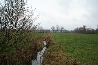
The Wischbek near Henstedt-Ulzburg |
||
| Data | ||
| Water code | DE : 595612 | |
| location | Segeberg district , Schleswig-Holstein , Germany | |
| River system | Elbe | |
| Drain over | Alster → Elbe → North Sea | |
| River basin district | Elbe | |
| source | In Kisdorf 53 ° 48 ′ 44 ″ N , 10 ° 2 ′ 24 ″ E |
|
| Source height | 72 m | |
| muzzle | In Henstedt-Ulzburg in the Alster Coordinates: 53 ° 46 '14 " N , 10 ° 0' 49" E 53 ° 46 '14 " N , 10 ° 0' 49" E |
|
| Mouth height | 27 m | |
| Height difference | 45 m | |
| Bottom slope | 7.7 ‰ | |
| length | 5.8 km | |
The Wischbek is a left tributary of the Alster .
geography
The Wischbek rises south of the Kisdorfer district Kisdorf rule, not far from the survey Rath pitchers (91 m). It flows into the Alster near Henstedt-Ulzburg in the Oberalsterniederung nature reserve . The Wischbek is occasionally mentioned as the source of the Alster. The Hamburg topographer Wilhelm Melhop describes the Wischbek in 1932 as "largely converted into straight trenches" and as "a rain stream that is often dry in summer".
vegetation
The Wischbek is largely surrounded by grassland . In sections it is lined with gallery forest.
Web links
Commons : Wischbek - Collection of images, videos and audio files
Individual evidence
- ↑ a b Annex GPV Alster-Rönne. (PDF; 969 KB) Sheet 6. Alster-Rönne Water Management Association, June 10, 2014, accessed on March 8, 2017 .
- ↑ Appendix index GPV Alster-Rönne. (PDF; 721 KB) Sheet 22. Alster-Rönne Water Management Association, June 10, 2014, accessed on March 8, 2017 .
- ↑ Peggy Wolf: Somewhere on the "Rathkrügen". In: taz. On the weekend. August 9, 2003, accessed March 8, 2017 .
- ^ Wilhelm Melhop: The Alster. Hartung, Hamburg 1932, p. 11 digitized .
- ↑ Biotope 325685962-428, available at Biotope Mapping Schleswig-Holstein Ministry for Energy Transition, Agriculture, Environment, Nature and Digitization of the State of Schleswig-Holstein , May 18, 2016, accessed on January 11, 2019.

