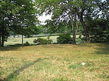
Wolfe's Pond Park

Wolfe's Pond Park is a public park on Staten Island in New York City , New York State . The park is maintained by the New York City Department of Parks and Recreation .
location
The park covers an area of approximately 1.2 square kilometers and is located on Lower New York Bay on the southern side of Staten Island, in an area called the South Shore . The park is bounded to the north by the Staten Island Railway , to the west by Holten Avenue, to the south by Lower New York Bay and Raritan Bay and to the east by Chisolm Street, Luten Avenue and Irvington Street. Hylan Boulevard runs through the middle of the park, the main entrance is Cormalia Street, which leads from Hylan Boulevard to the parking lot in the southern part of the park. There is also Wolfe's Pond , a lake that almost reaches the beach, two playgrounds, various sports fields and access to the beach. The northern part of the park is more pristine, mainly forests with lakes. Tottenville High School is in the northeast corner.
history
The landscape in which the park is located was created around 20,000 years ago at the end of the last ice age. As the Wisconsin Ice Shield spread south, it carried large amounts of sand, clay, and gravel. Some of this material is still visible on the beach in the park today. About 6,000 years ago, Native Americans settled in the area and, in addition to fishing and hunting, lived on crops such as pumpkin and corn that they grew here. When the Europeans first arrived here in the 17th century, an industry developed on the south shore of Staten Island for the fishing and processing of oysters , which were high populated and commercially caught in the bay. Furthermore, the owner Joel Wolfe farmed his land here . In 1857 New York State bought the land to set up a quarantine station for sick immigrants. This facility was later relocated to the man-made islands of Hoffman Island and Swinburne Island , and the land was sold to a private investor in 1907. In 1929 the city of New York bought the land. At that time there were numerous summer cottages around the lake. In 1933 these buildings were demolished and the parks created. Furthermore, a dam was built between the sea and the lake to prevent flooding with salt water. In 1941 the city wanted to build Wolfe's Pond Parkway , which would connect Richmond Parkway to the park. This 1.6-kilometer section, which was introduced by the influential city planner Robert Moses , was never built. In the maps of the region, however, it was still shown as being planned until the 1970s.
reachability
In addition to the possibility of visiting the park by car via Hylan Boulevard, the park can be reached on foot from Prince's Bay station on the Staten Island Railway. Several bus routes also operate on Hylan Boulevard.
Trivia

The criminal Costabile Farace murdered a 17-year-old boy on October 8, 1979 together with three other cronies and injured his 16-year-old friend in the park.
In 1991 and 2011 the dam between the lake and the sea was flooded and collapsed. The salt water entering the lake killed many of the freshwater fish and turtles that live there .
In 2011 a Super Spartan Race was held in the park. This is a special obstacle course over 8 miles with over 20 different tests and obstacles.
Every year on July 4th, Independence Day , a festival with large fireworks takes place in the park, which attracts many spectators to the park.
Individual evidence
- ^ Wolfe's Pond Park at New York City Department of Parks & Recreation
- ↑ a b The Beach at Wolfe's Pond Park
- ↑ Wolfe's Pond Parkway at New Yor City Roads
- ^ "Death of a Hood" by Eric Pooley, New York Magazine January 29, 1990
- ↑ Freshwater Wolfe's Pond is filled with salt water Staten Island Live Sept 7, 2011
- ↑ Spartanrace Home Page
Coordinates: 40 ° 31 ′ 18 " N , 74 ° 11 ′ 35" W.
