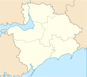
Vosnesenka (Melitopol)
| Vosnesenka | ||
| Вознесенка | ||

|
|
|
| Basic data | ||
|---|---|---|
| Oblast : | Zaporizhia Oblast | |
| Rajon : | Melitopol district | |
| Height : | 7 m | |
| Area : | 11.63 km² | |
| Residents : | 5,123 (2004) | |
| Population density : | 440 inhabitants per km² | |
| Postcodes : | 72360 | |
| Area code : | +380 6192 | |
| Geographic location : | 46 ° 52 ' N , 35 ° 27' E | |
| KOATUU : | 2323080801 | |
| Administrative structure : | 1 village | |
| Address: | вул. Кірова 205 72360 с. Вознесенка |
|
| Statistical information | ||
|
|
||
Voznesenka ( Ukrainian and Russian Вознесенка ) is a village in the south of the Ukrainian Oblast of Zaporizhia with about 5100 inhabitants (2004).
The village is located on the left bank of the Molochna, northeast of the city of Melitopol and north of the village of Kostjantyniwka, and is the only place in the 109.07 km² district council of the same name in Melitopol district .
At the beginning of the First World War, 2776 people lived in the village, which was founded in 1861, and by the end of 1920 the population rose to 7975 inhabitants. The village was occupied by the Wehrmacht between October 5, 1941 and October 14, 1943 .
Web links
Commons : Vosnessenka - collection of images, videos and audio files
Individual evidence
- ^ Website of the village on the website of the Verkhovna Rada ; accessed on August 2, 2017 (Ukrainian)
- ^ Website of the district council on the website of the Verkhovna Rada; accessed on August 2, 2017 (Ukrainian)
- ^ Voznesenka on cities and municipalities of the Zaporizhia Oblast as part of the Ukrainian SSR ; accessed on August 2, 2017 (Ukrainian)


