Wouri (river)
|
Wouri Vouri, Vuri |
||
|
The Wouri just before the mouth |
||
| Data | ||
| location |
Province |
|
| River system | Wouri | |
| Drain over | Cameroon estuary → Bay of Bonny | |
| origin | Confluence of Nkam and Makombe 4 ° 34 '11 " N , 10 ° 9' 49" O |
|
| muzzle |
Cameroon estuary , Gulf of Guinea Coordinates: 4 ° 5 ′ 0 ″ N , 9 ° 42 ′ 0 ″ E 4 ° 5 ′ 0 ″ N , 9 ° 42 ′ 0 ″ E
|
|
| length | 160 km | |
| Catchment area | 11,700 km² | |
| Discharge at the Yabassi A Eo gauge : 8250 km² Location: 50 km above the mouth |
NNQ (min. Month Ø) MNQ 1951–1977 MQ 1951–1977 Mq 1951–1977 MHQ 1951–1977 HHQ (max. Month Ø) |
34.3 m³ / s 64.9 m³ / s 311 m³ / s 37.7 l / (s km²) 811 m³ / s 1065 m³ / s |
| Left tributaries | Sang | |
| Right tributaries | Abo , dibombe | |
| Big cities | Douala | |
| Small towns | Yabassi | |
| Navigable | 64 kilometers | |
The Wouri (also Vouri or Vuri , German Wuri ) is a river in Cameroon .
course
The Wouri is a coastal river in southwest Cameroon. it is formed from the confluence of the rivers Nkam and Makombé , 32 kilometers northeast of the city of Yabassi . From there it flows a further 160 kilometers in a south-westerly direction until it flows into the Cameroon estuary at Douala , in the Bay of Bonny.
History of the name of the river
In 1472 the sailors Fernão do Pós invaded the mouth of the Wouri, where they were inspired by the abundance of crabs and consequently named the river Río dos Camarões . From the 16th century to the beginning of the 20th century, the Wouri was known under the name Camarones (“crab” in Spanish), which is where the current name of Cameroon comes from. During the German colonial era it was called the Wuri or the Cameroon River and the adjoining sea area was called the Cameroon Estuary .
- The wouri
Hydrometry
The flow rate of the river was measured in Yabassi in m³ / s

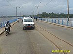
The bridges of Bonabéri
Between 1952 and 1954, the French colonial rulers built a bridge that connects Bonabéri with Douala. Since November 2013 another bridge has been built right next to this bridge, which is important for West Cameroon. The cost of the project was estimated at € 129 million and the construction time at 36 months. It was also planned to employ more than 500 previously trained Cameroonian construction workers as well as foremen and site managers, mostly of African origin. The structure, which consists of several bridge fields with a span of 135 m over a length of 760 m, comprises a railroad track (completion: November 2016), five lanes and two sidewalks. It was completed in mid-2017.
Web links
Individual evidence
- ↑ Poissons d'eaux douces et saumâtresde basse Guinée, ouest de l'Afrique centrale
- ↑ a b PDF on the hydrology of Cameroon (French) Accessed July 25, 2018
- ↑ Entry "Wuri" in the colonial dictionary
- ↑ 84 per cent of structural works on second bridge over Wouri completed. businessincameroon.com, January 21, 2017, accessed July 8, 2018
- ↑ Article on the website of the French construction company Vinci from January 1, 2014. Online: [1]
- ↑ Article on the website of the French construction company Vinci from January 12, 2017. Online: [2]


