Zantberg
| Zantberg | ||
|---|---|---|
|
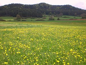
Hohe Zant looking west to east |
||
| height | 646.8 m above sea level NN | |
| location | District of Amberg-Sulzbach , Bavaria ( Germany ) | |
| Mountains | Hersbrucker Alb , Franconian Alb | |
| Coordinates | 49 ° 34 '13 " N , 11 ° 38' 16" E | |
|
|
||
The Zantberg , also just called Zant or Hohe Zant , is 646.8 m above sea level. NN the second highest elevation in the Upper Palatinate Jura and is located in the district of Amberg-Sulzbach north of Neukirchen near Sulzbach-Rosenberg .
A hut on the summit is managed on the weekends. The summit can only be reached on foot or by bike via numerous hiking trails, starting from Eschenfelden or Neukirchen.
There was a wooden observation tower on the summit until the 1960s .
Individual evidence
- ↑ Location Zantberg in the Bayern Atlas (accessed on January 29, 2013)
- ↑ Hiking suggestion to the Zant (accessed January 29, 2013; PDF; 1.6 MB)
Web links
Commons : Zantberg - collection of images, videos and audio files


