
Zeidelweide and Pfaffenloh
|
NSG Zeidelweide and Pfaffenloh
|
||
 Path in the Zeidelweidetal in the NSG |
||
| location | Adorf / Vogtl. , Saxony , Germany | |
| surface | 33 ha | |
| Identifier | C 56 | |
| WDPA ID | 166395 | |
| Geographical location | 50 ° 18 ' N , 12 ° 13' E | |
|
||
| Setup date | 1987 | |

Zeidelweide and Pfaffenloh is a nature reserve (NSG) in the Adorf / Vogtl area. in the Vogtlandkreis in the southwest of Saxony .
location
The nature reserve is located between Bad Elster and Adorf, about 1 km from the western border with the Czech Republic . It consists of three separate areas: the upper part of the Zeidelweidebach valley with two side valleys and the sub-areas "Pfaffenloh" and "Wiese am Schlossweg" to the north of it.
The source of Zeidelweidebachs is close to the Czech border between Arnsgrün and Bärenloh little east of the Old Castle Schonfeld mentioned archaeological monument . The stream runs to the east and flows into the White Elster after about 2.2 km near the federal highway 92 .
meaning
A part of the area was already under protection from 1987 as a nature reserve "Zeidelweide". The now 33 hectare area with the NSG identification C 56 has been designated as a nature reserve since 2006 because of the biodiversity in fauna and flora. In 1991 there were 60 plant species on Saxony's Red List , including six orchid species . The occurrence of 364 butterfly and 11 dragonfly species at that time is remarkable .
The part of the nature reserve stretching along the Bachtal is accessible to visitors on paths.
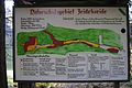
Information board about the old NSG Zeidelweide

Forest path in the upper part of the Zeidelweidetal

Ring wall system Elster ("Old Castle") in the NSG

A paved path in the lower part of the Zeidelweidetal


See also
literature
- Bruno Rudau, Max Meinel, Erich Stübiger: Bad Elster, Sohl - Radiumbad Brambach , series: Our little traveling booklet, issue 8, Leipzig 1957
Web links
- Nature reserve "Zeidelweide and Pfaffenloh" on sachsen.de


At the old raft ditch | At the Ullitz | Brauhauspöhl | Threefold | Dreiländereck | Elsterhang near Pirk | Elsterhang near Röttis | Feilebach | Fuchspöhl | Goldberg | Gottesberg | Great crane lake | Large willow pond | Grünheider high moor | Hasenreuth | Kingdom of Heaven | Hirschberg | Hüttenbach | Jägersgrüner Hochmoor | State municipality | Muldenwiesen | Pausaer pasture | Pfarrwiese | Rauner- and Haarbachtal | Sachsenwiese | Sand pit pond | Sohrwiesen | Steinberg | Steinicht | Stone meadows | Syrau-Kauschwitzer Heide | Triebal | Lower Kemnitztal | Burgteich bird sanctuary | Wartberg Thossen | Wash pond Reuth | Magic forest | Zeidelweide and Pfaffenloh | Zwiebrandwiesen